Snowshoeing Solitude

Snowshoe to First Creek Cabin

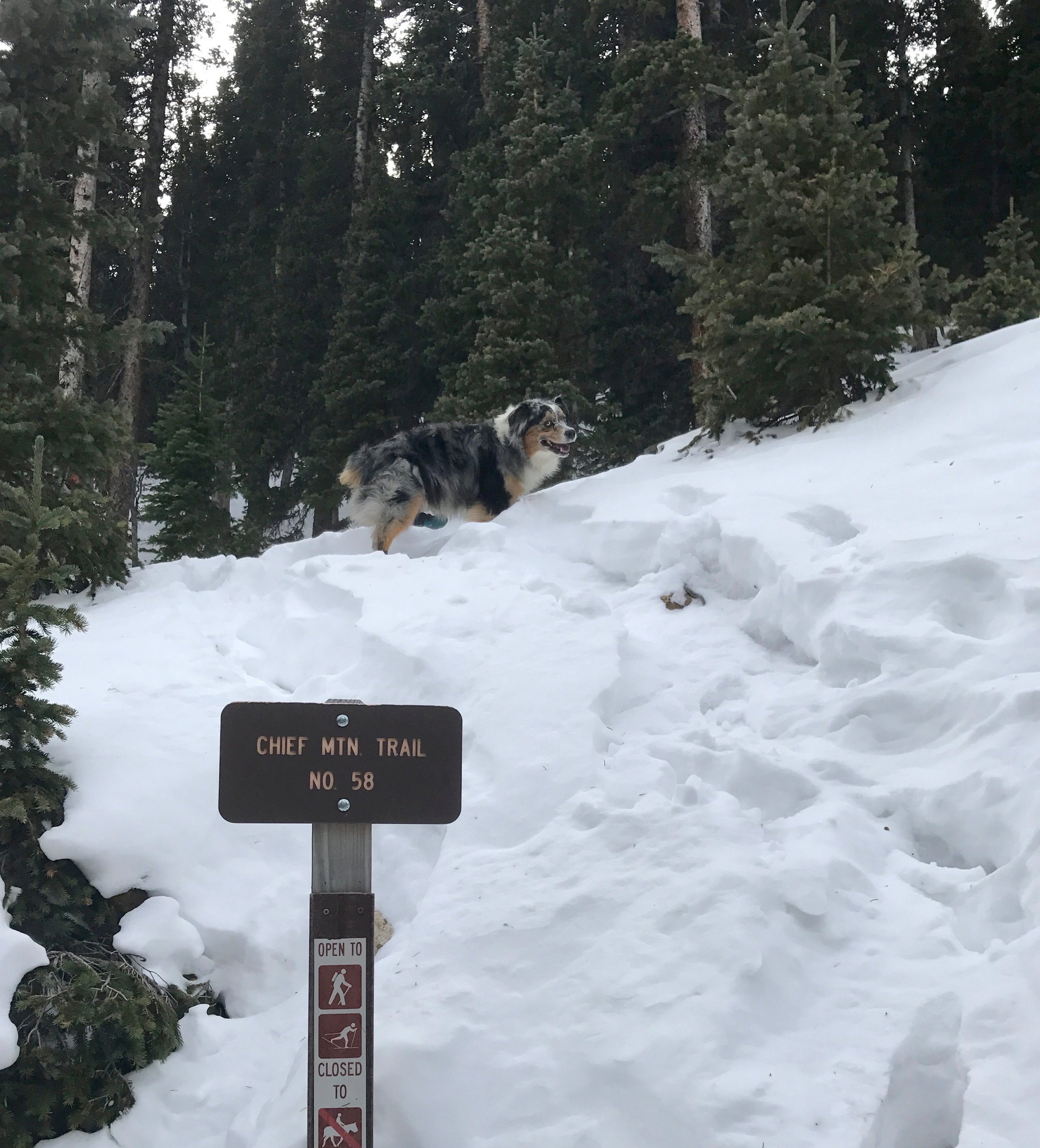
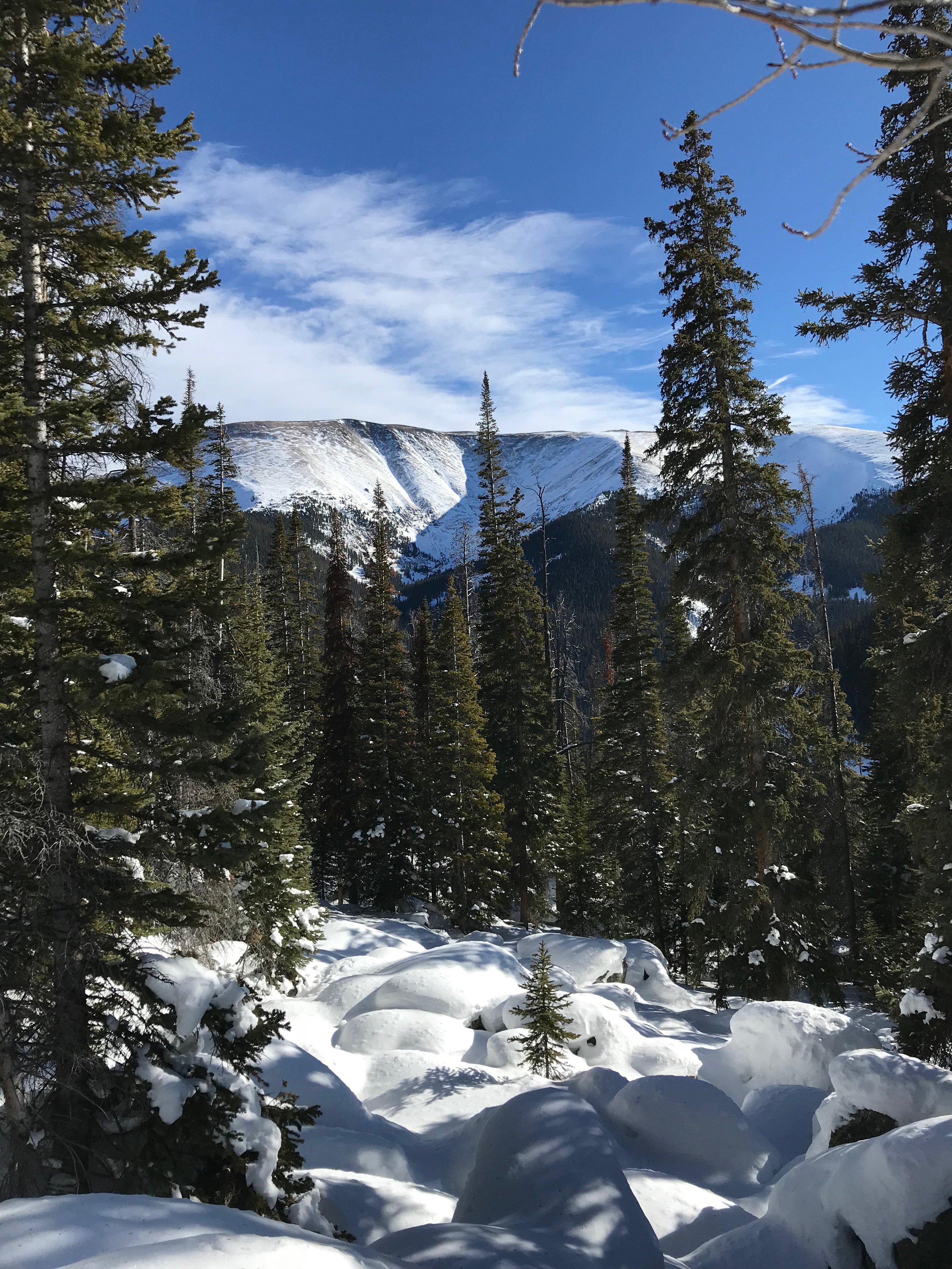
Wembley and I had been here before. About fourteen hours ago to be exact. Wembley is an Australian shepherd and a frequent companion on my adventures, especially if his Mom, my girlfriend Maura, is otherwise indisposed. Yesterday, Wembley and I had gotten too late a start on this same adventure, the lateness only realized after struggling to break trail through the thigh-deep conditions we had found on the route in this modest though beautiful drainage north of Berthoud Pass. Today, knowing better what lay ahead, we returned more determined (and earlier in the morning) to reach our destination: the First Creek Ski Cabin.

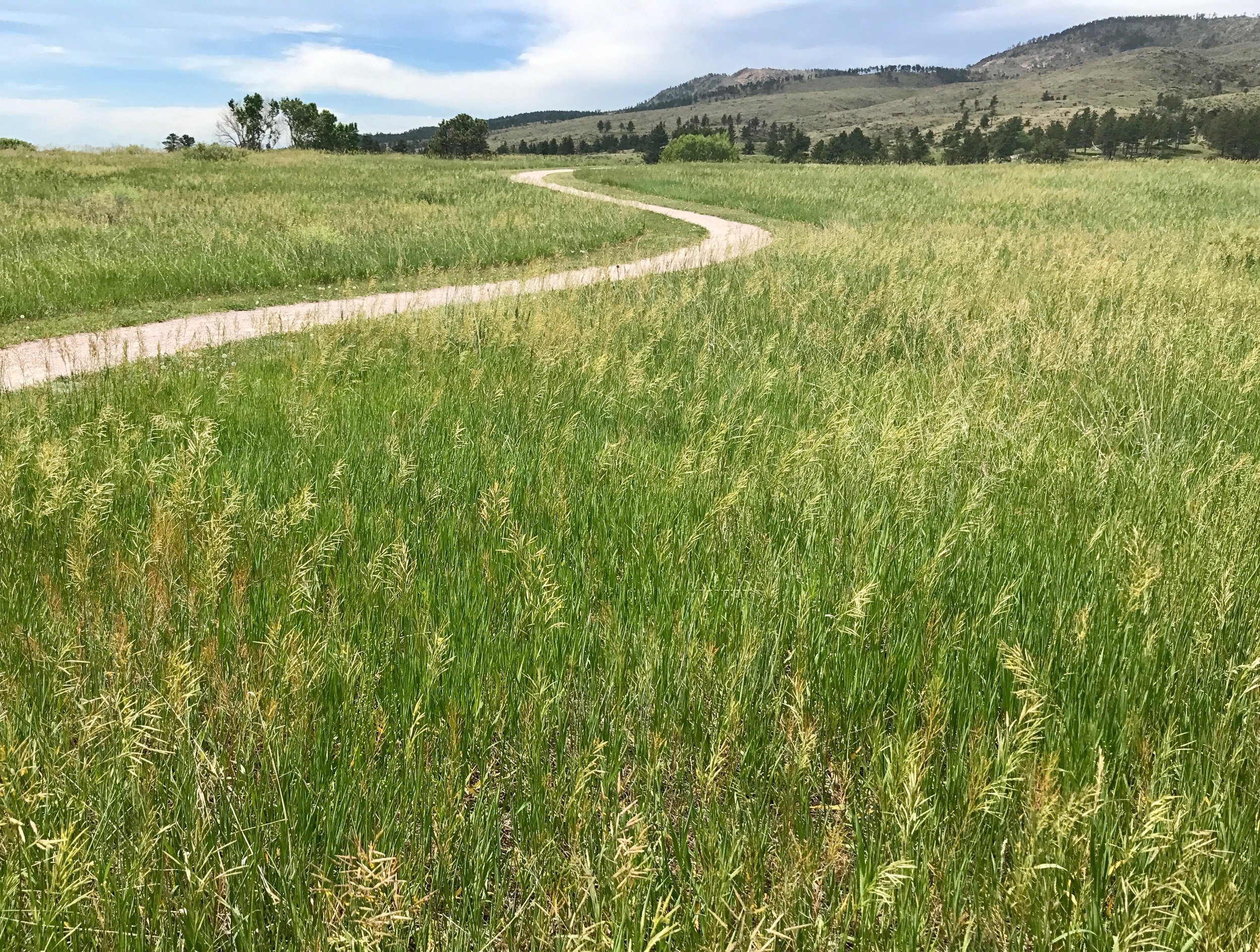
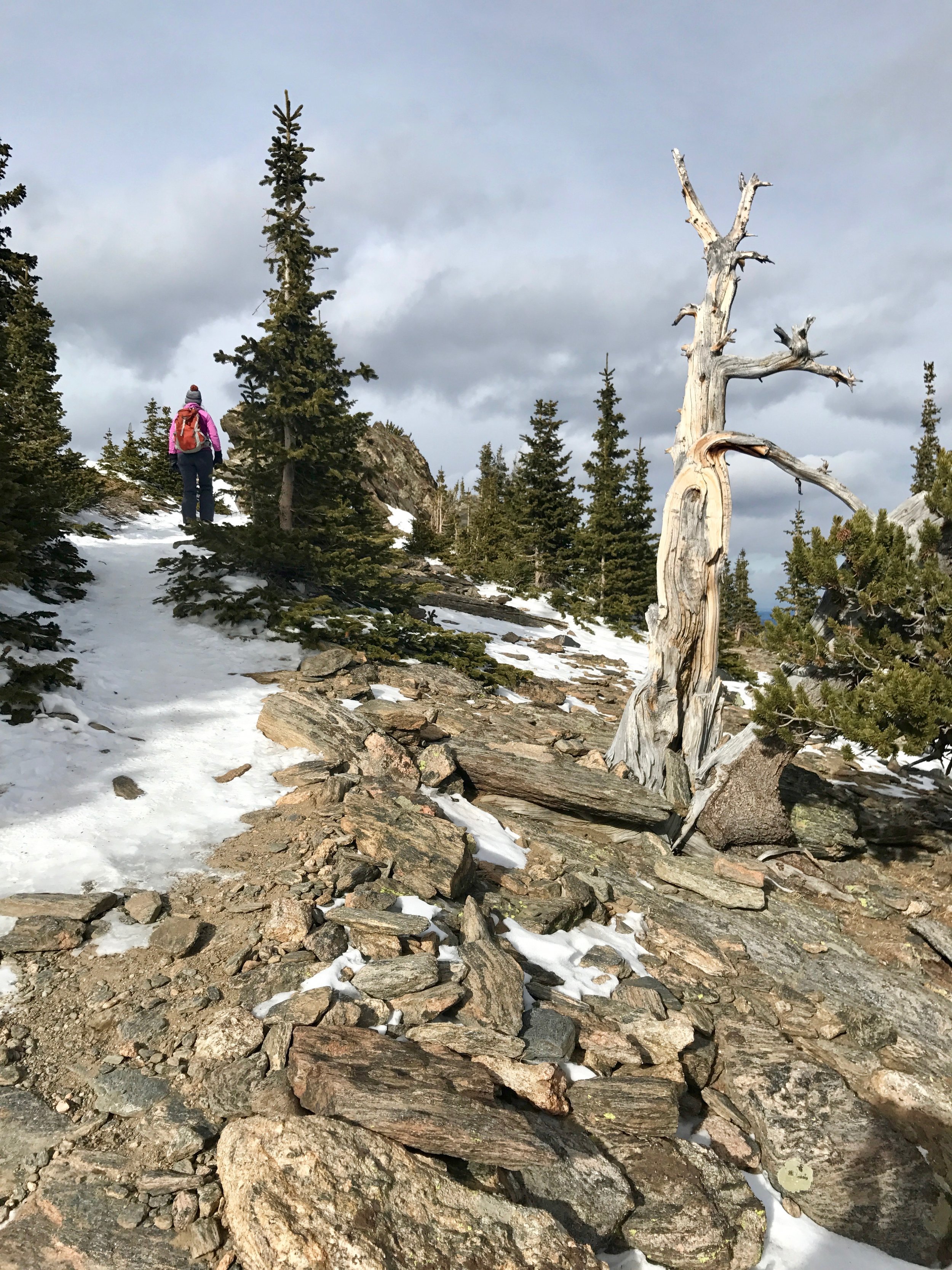
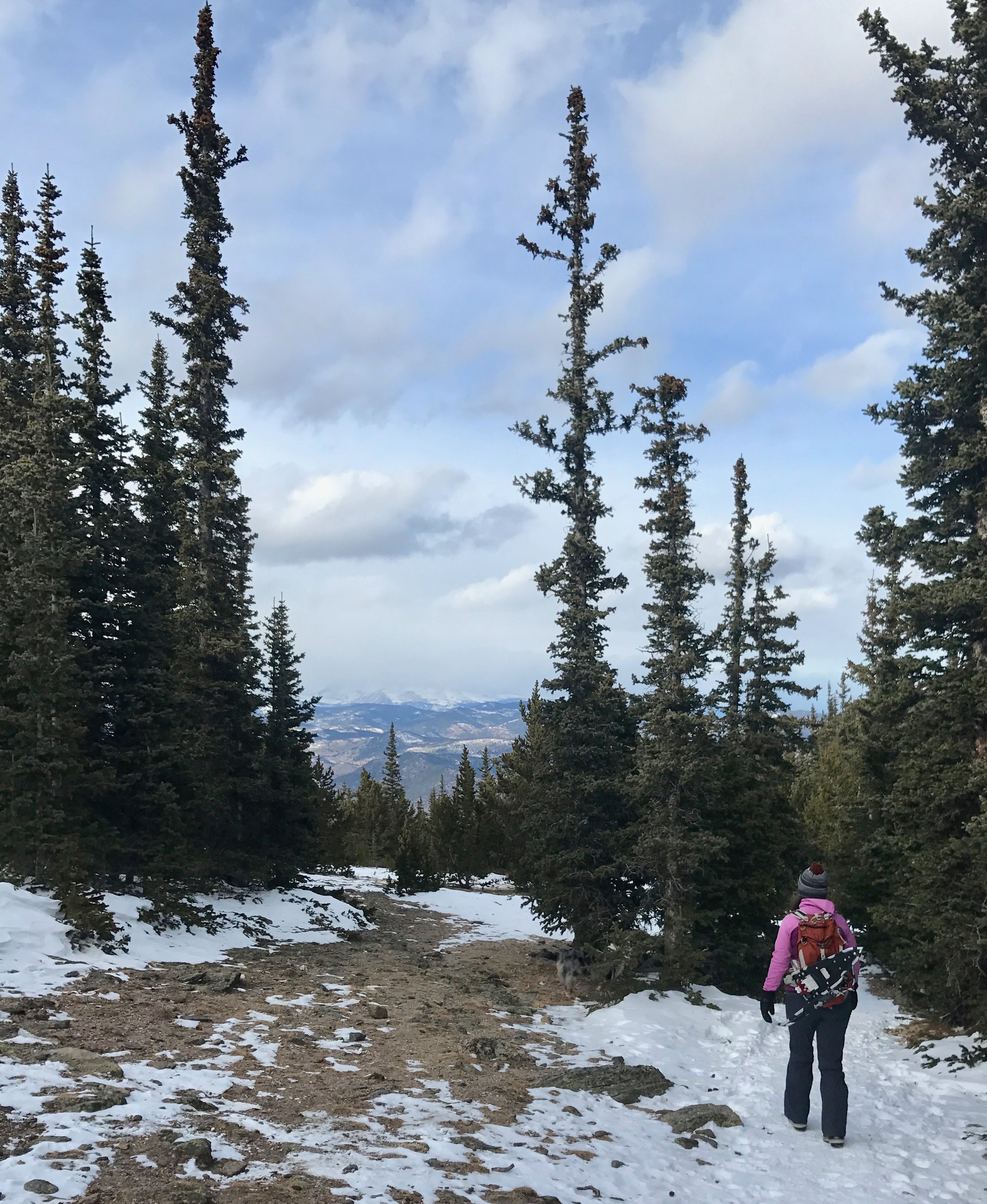
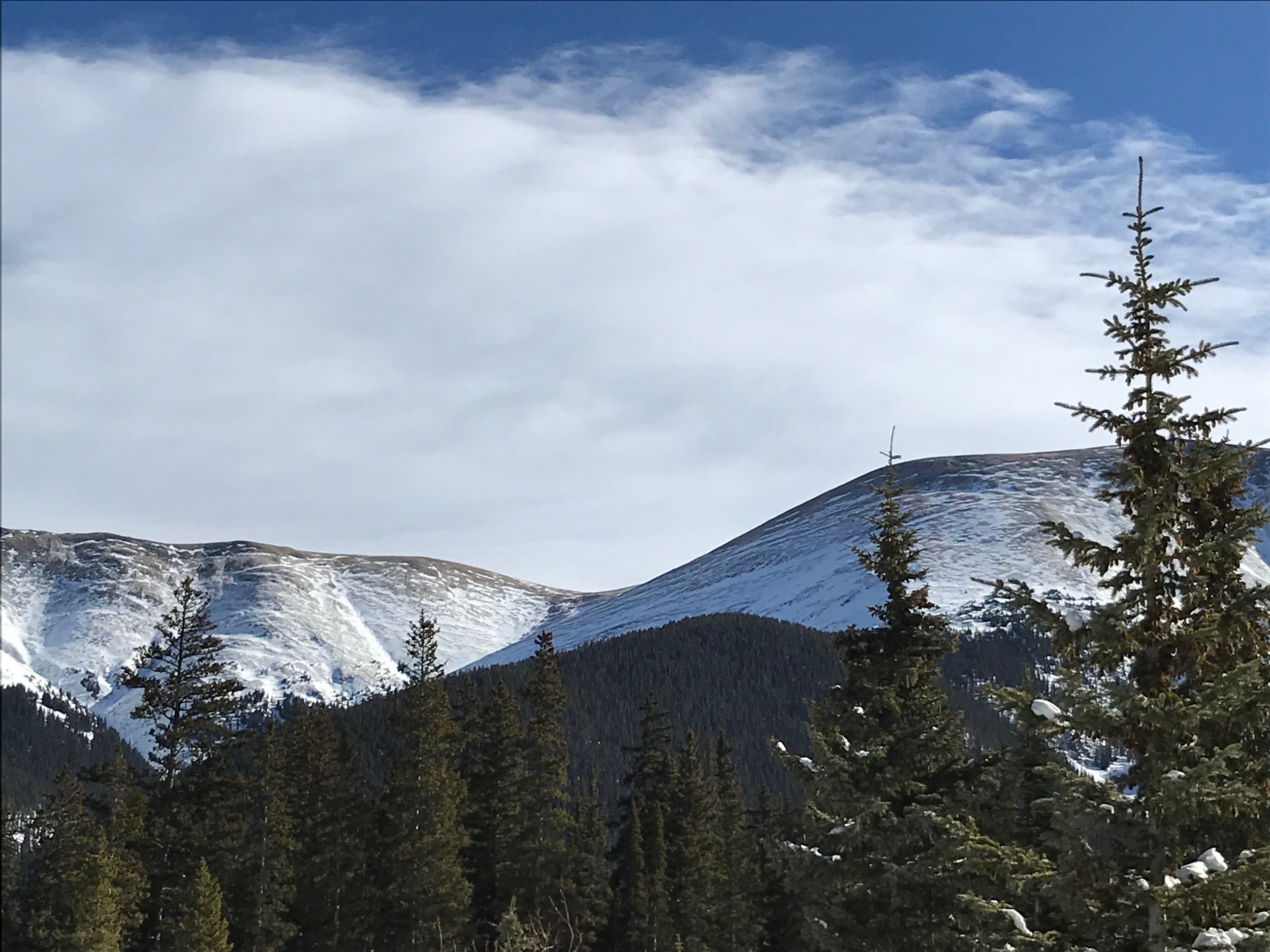
We drove by full parking lots bristling with backcountry skis and their skiers at Berthoud Pass, Current Creek, and Second Creek to an empty lot where First Creek bisects Highway 40. Empty. It's rare these days to find this kind of trailhead in the Front Range and I felt fortunate to be in-the-know about this site. The neighboring drainages and ridgelines have more dramatic and open terrain to offer skiers and so First Creek remains often overlooked in the winter time. I fitted polar booties to Wembley's paws and strapped snowshoes to my own feet before climbing the steep snowbank at the edge of the parking turnout to once again follow the path that we had blazed the day before.

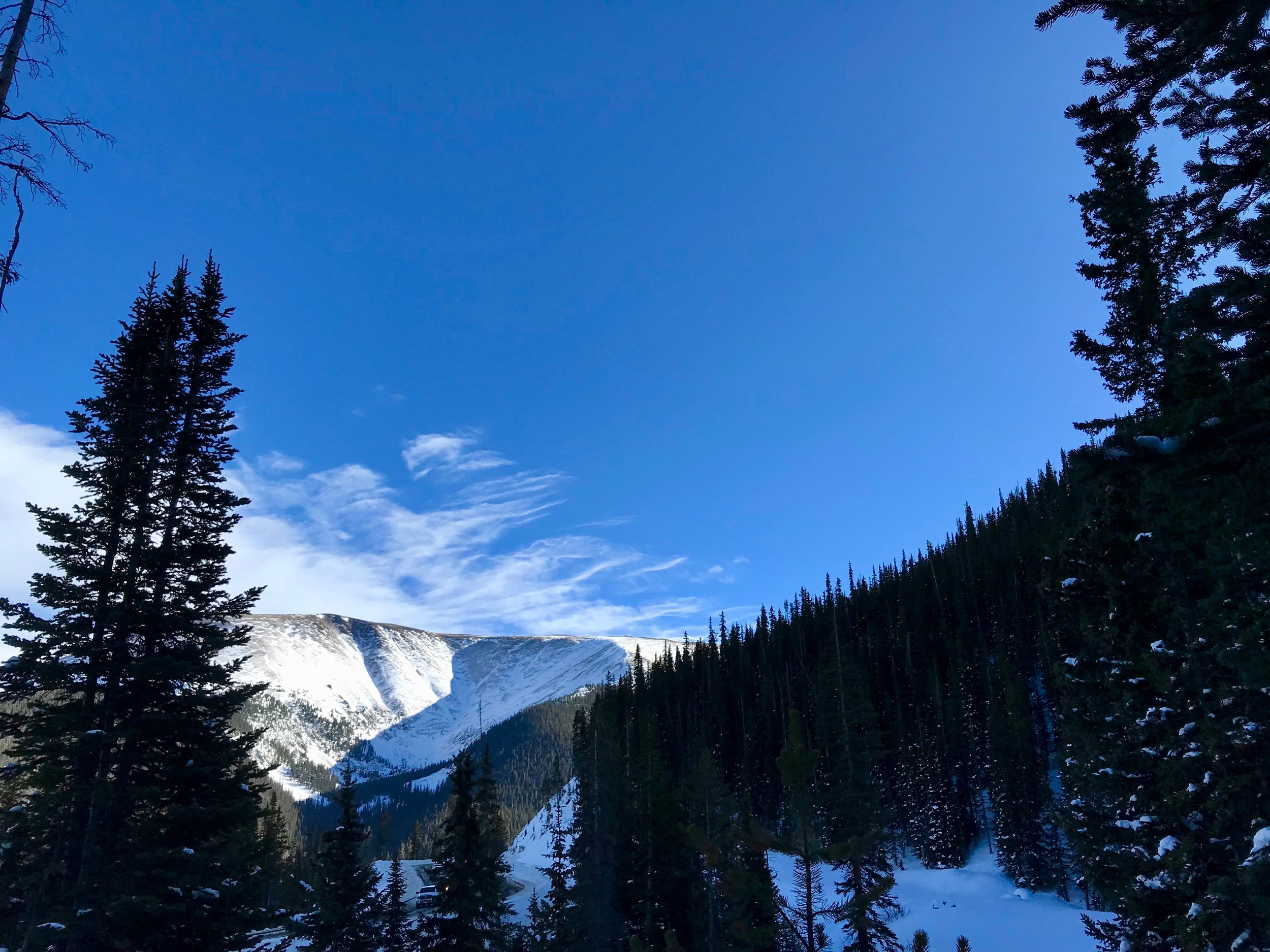
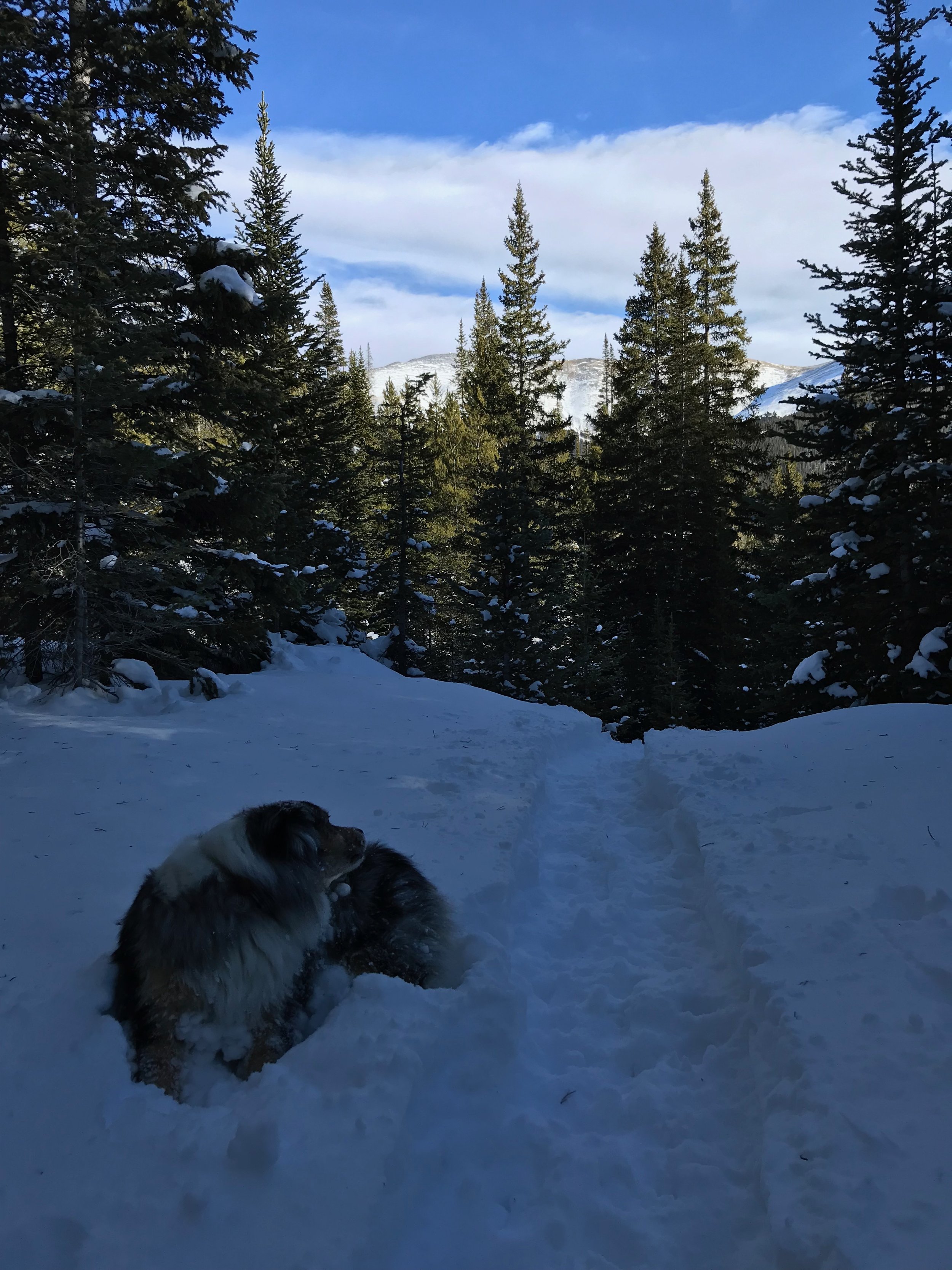
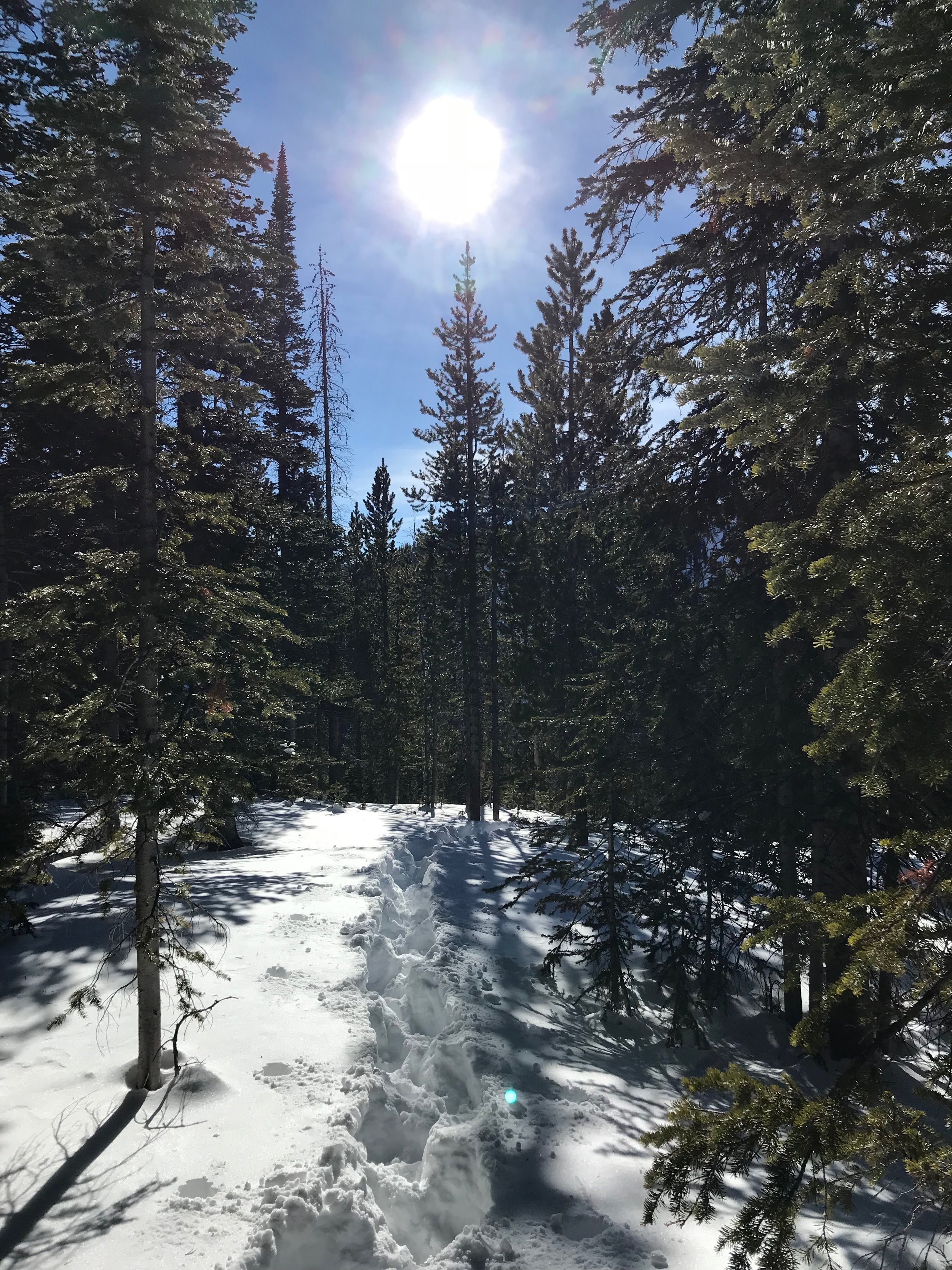
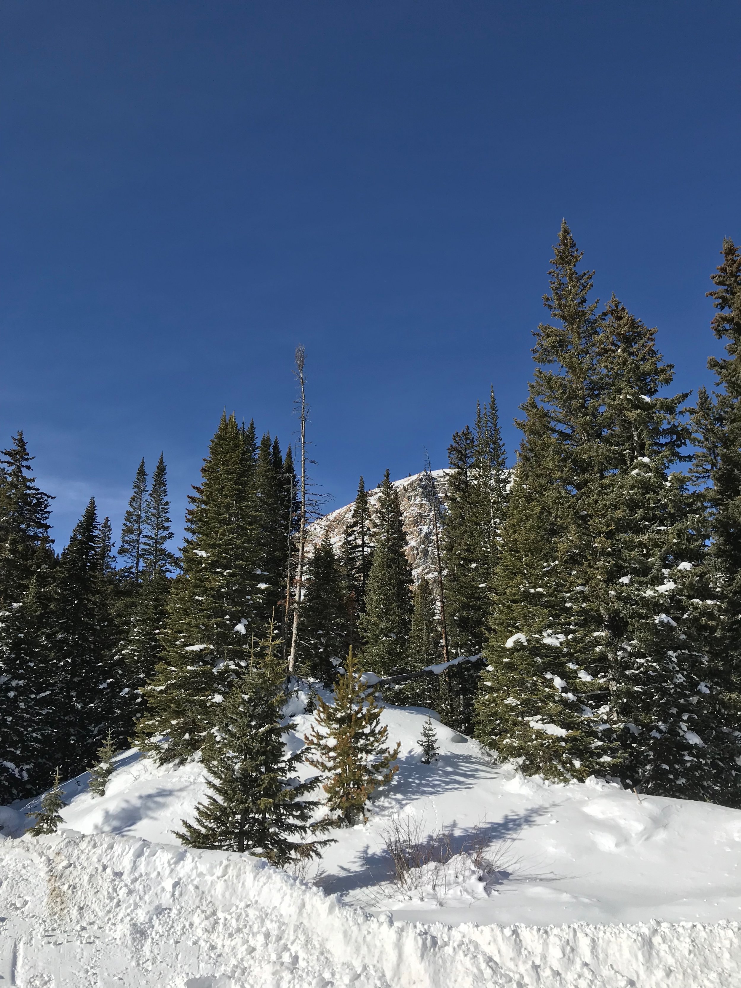
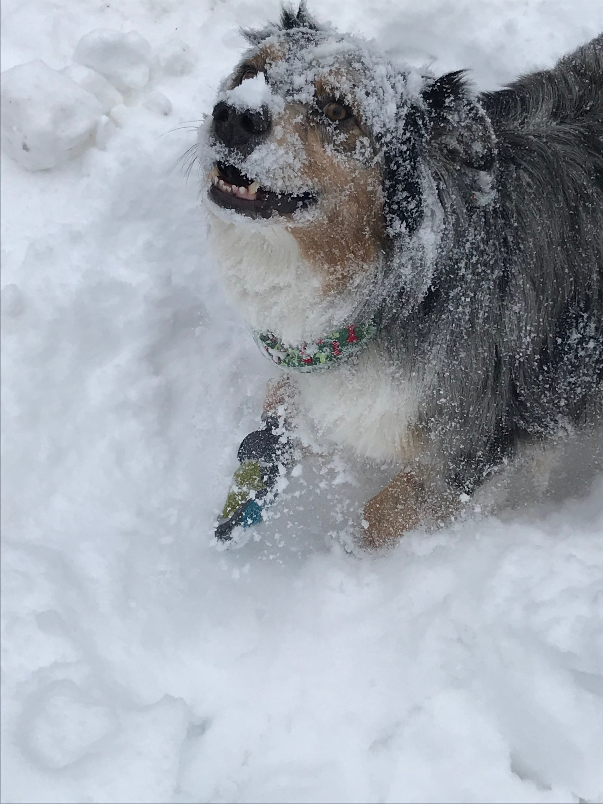
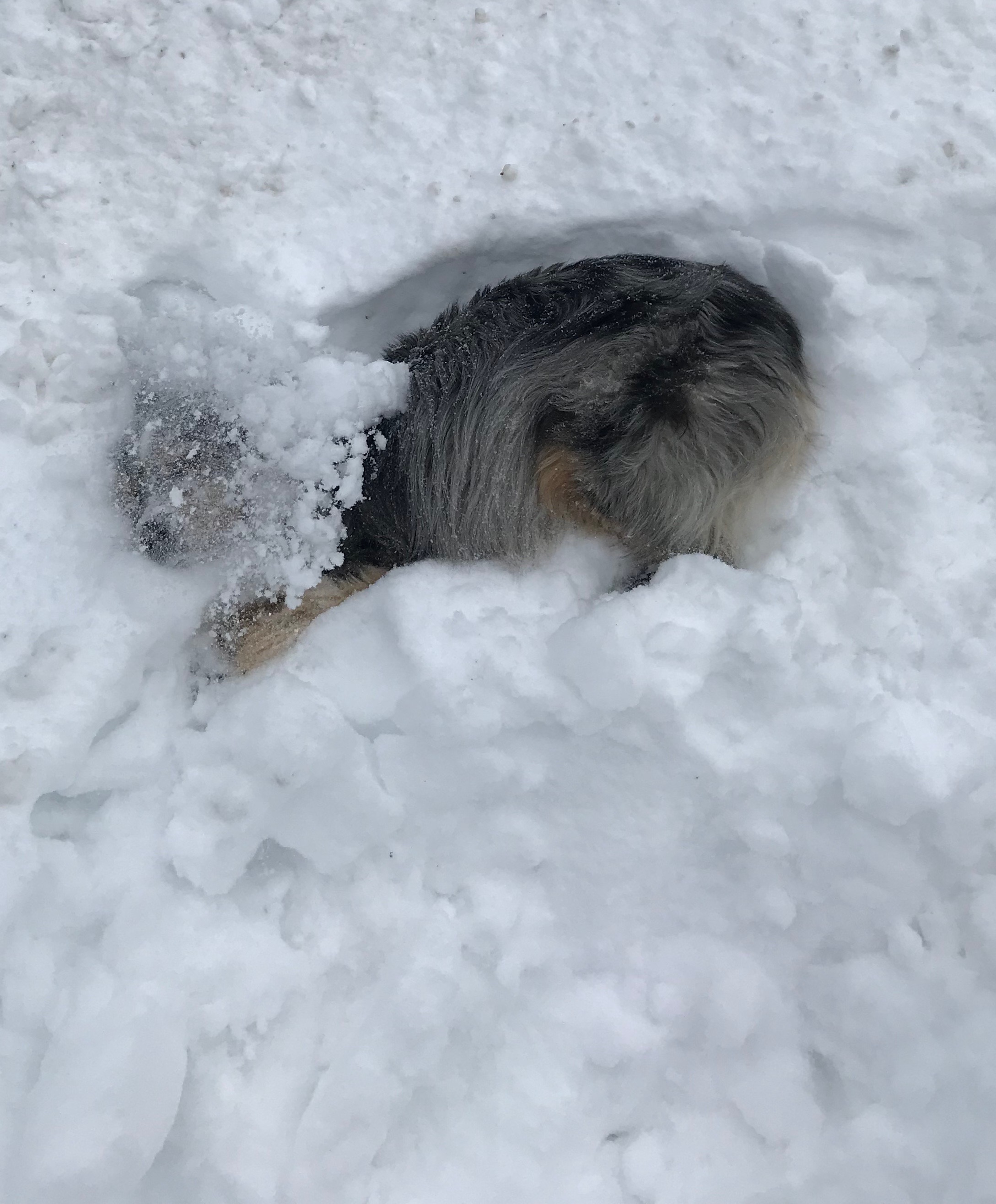
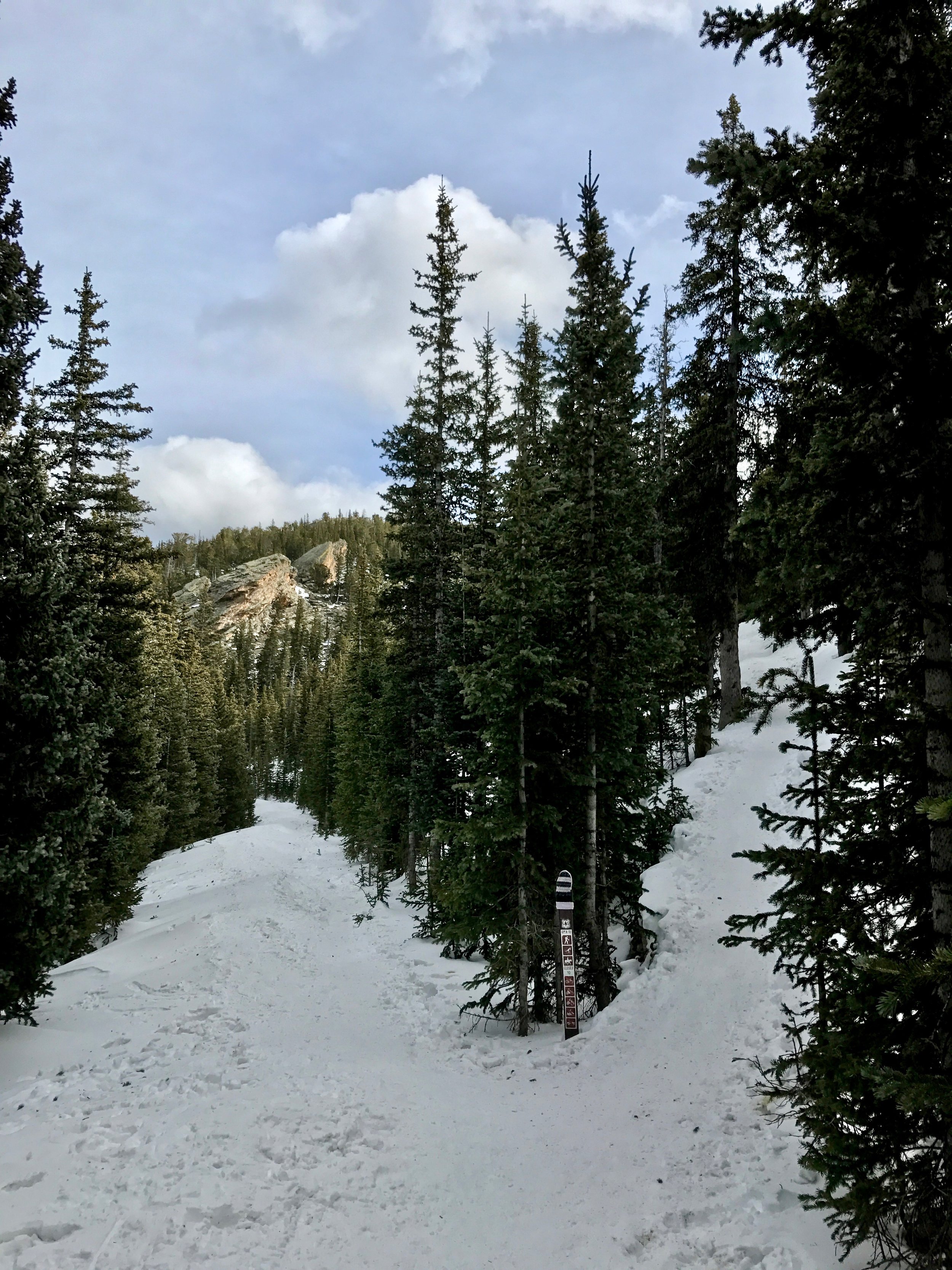
I knew today's trek would be strenuous. I had been here before, even before yesterday and clomped up to the hut on a prior visit. The route is steep and poorly marked. It generally follows the north bank of first creek before zigging and zagging up a prow of rock that is alternatively heavy with timber or large boulderfields. The first quarter mile passed quickly given that we had yesterday’s track to follow and Wembley happily bounded ahead of me, occasionally stopping to flop into the deep snow and shower his face and back with refreshing mountain snow. He has always been a snow dog and his mom shares stories from his puppyhood recalling his instant joy upon his first encounter with the glory of winter.

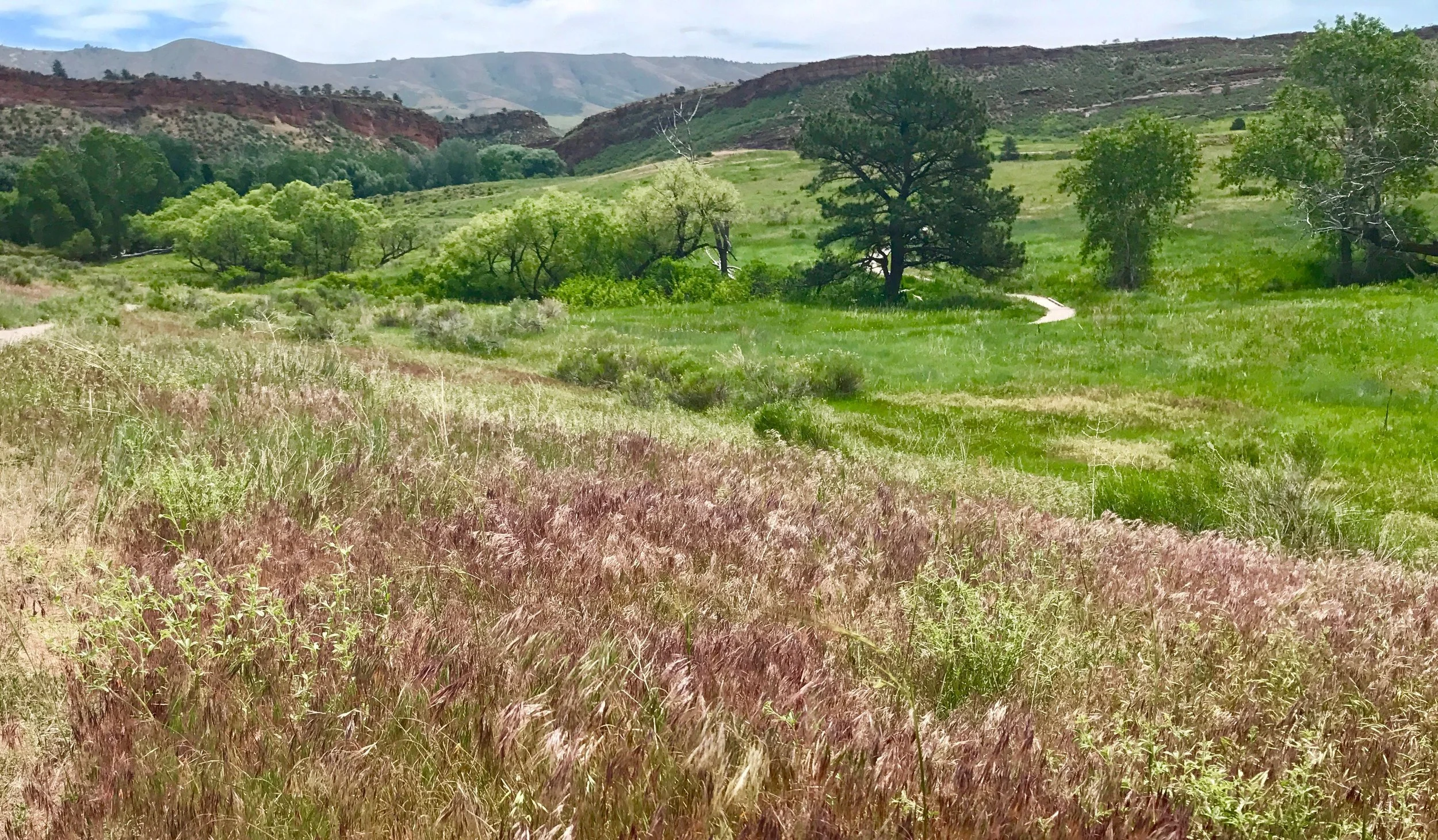
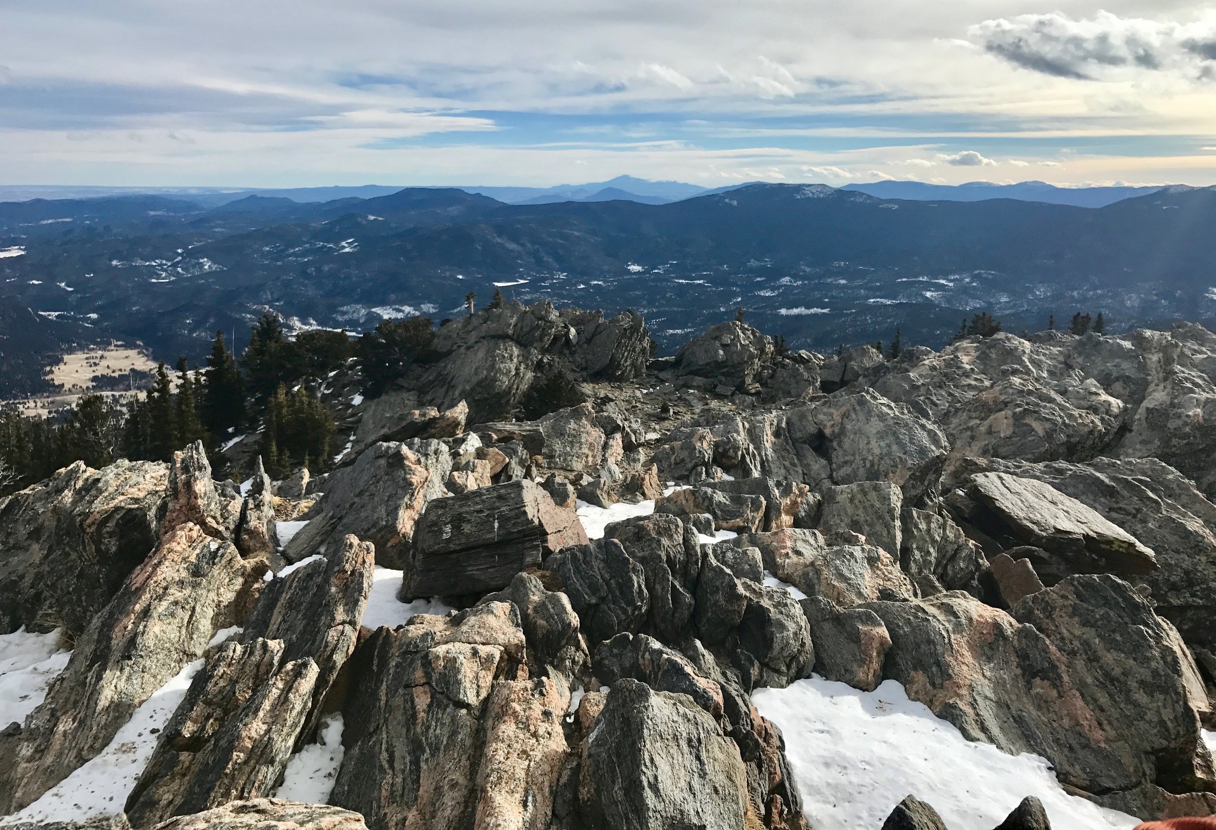
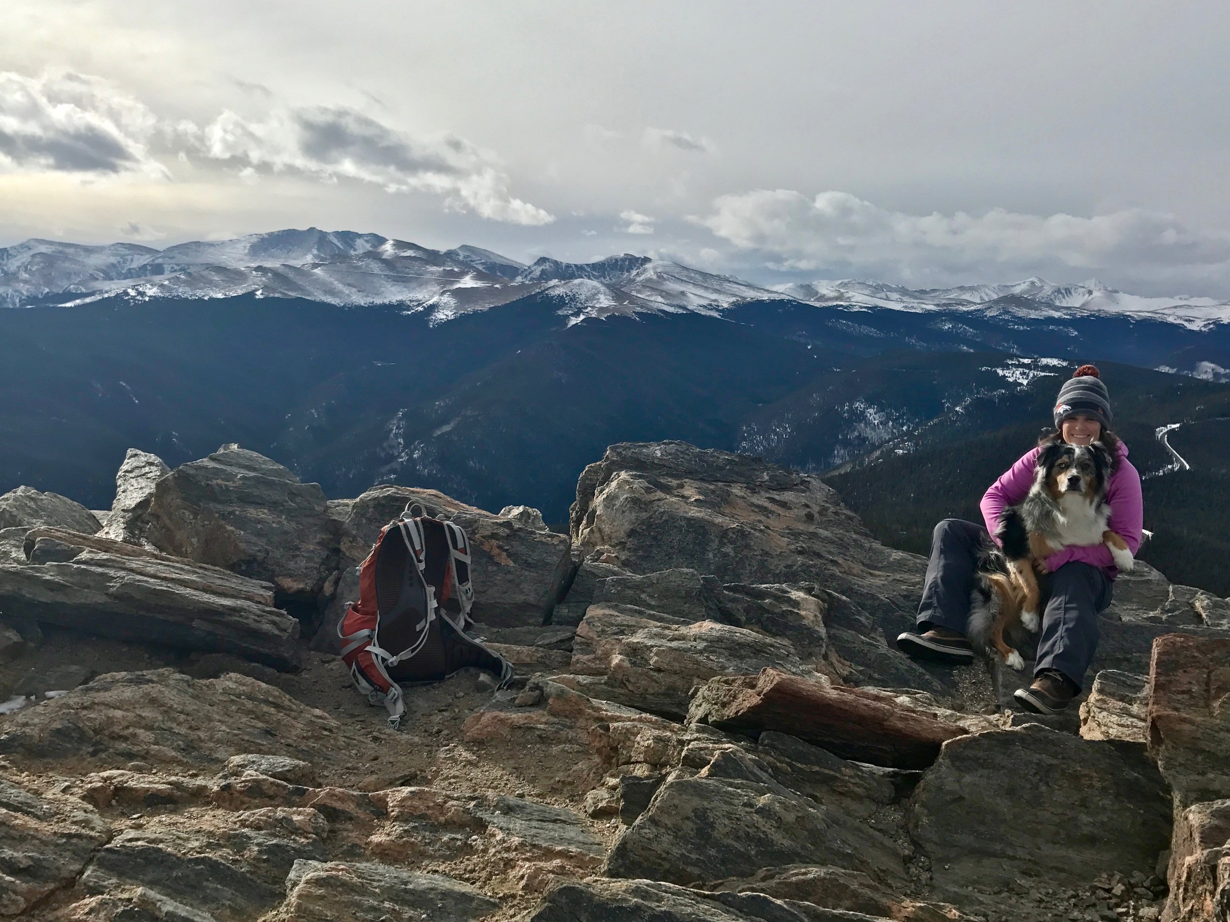
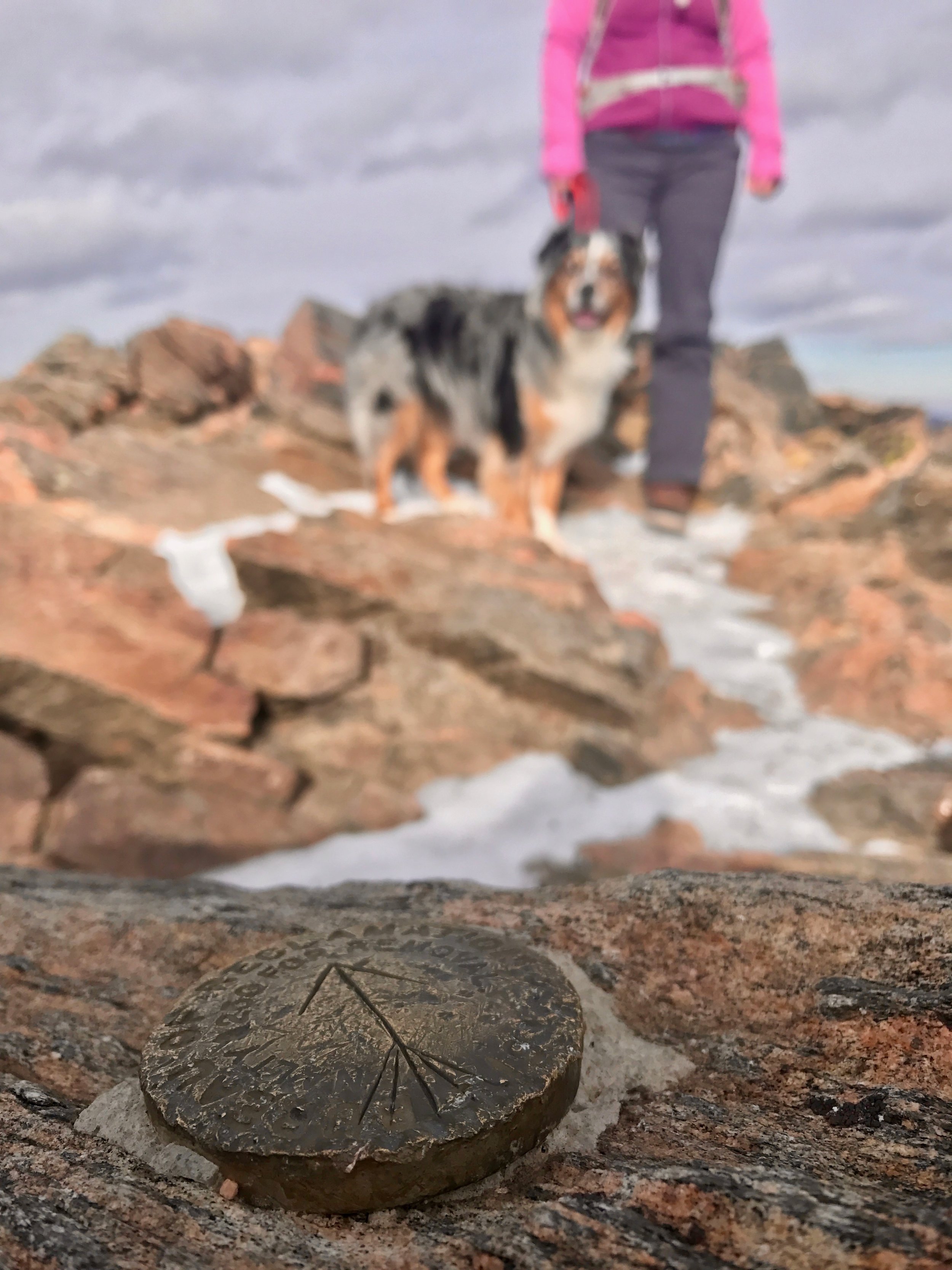
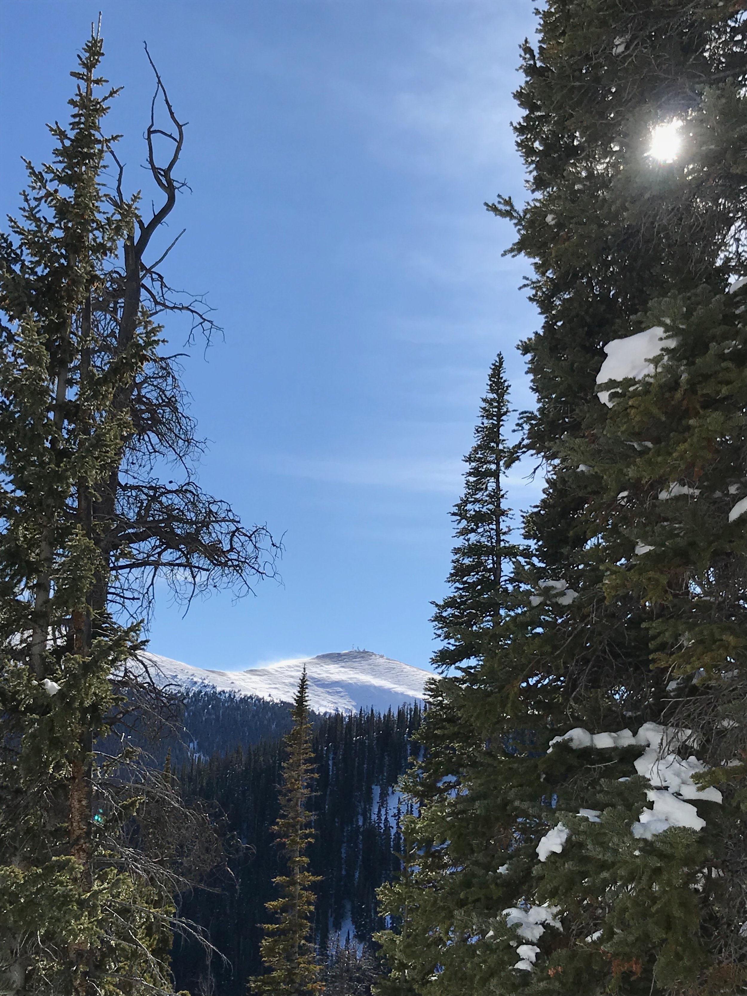
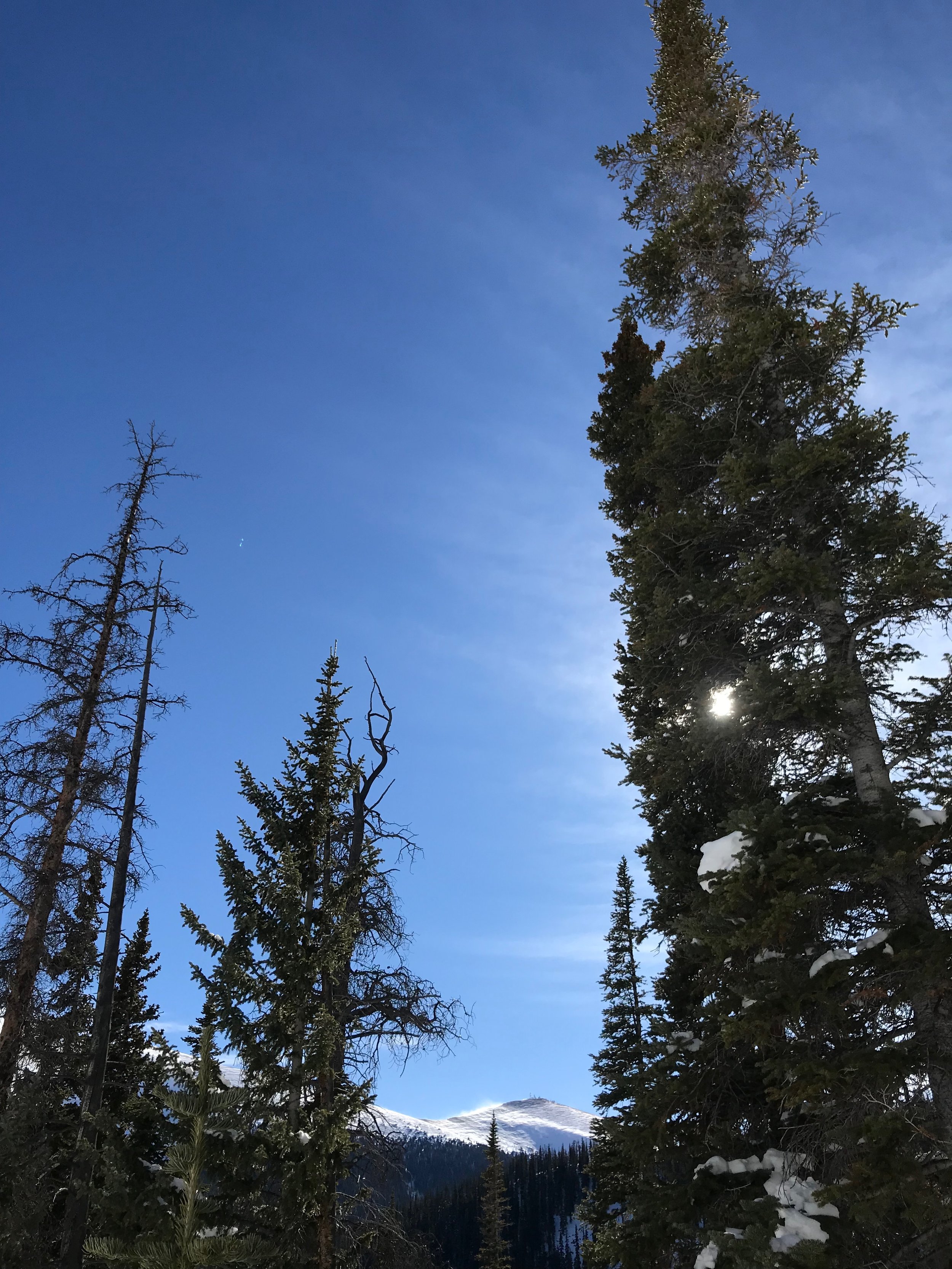
Upon reaching the end of our track we pushed into deep, uncharted snow and Wembley smartly decided it was time for me to break trail. We moved slowly and with difficulty. Despite the trail I was breaking, Wembley would often sink chest deep with each step. Still, his enthusiasm did not diminish. We turned away from the creek and climbed to an open bench, then angled back toward the highway. The faint trail I used on my last visit eluded me today. We would continue making our own trail instead. The sun rose up and warmed the air. The trees thinned. I picked along a circuitous route up the slope, winding around trees, weaving between boulders, ducking under logs, and climbing over rocks. On a few occasions, a concerned whimper would alert me that the route had stymied Wembley, his shorter legs unable to complete a high step or bridge a gap. I would stomp back a few yards to find him stranded though a lift him or nudge would allow us to resume our steady trudge upslope.

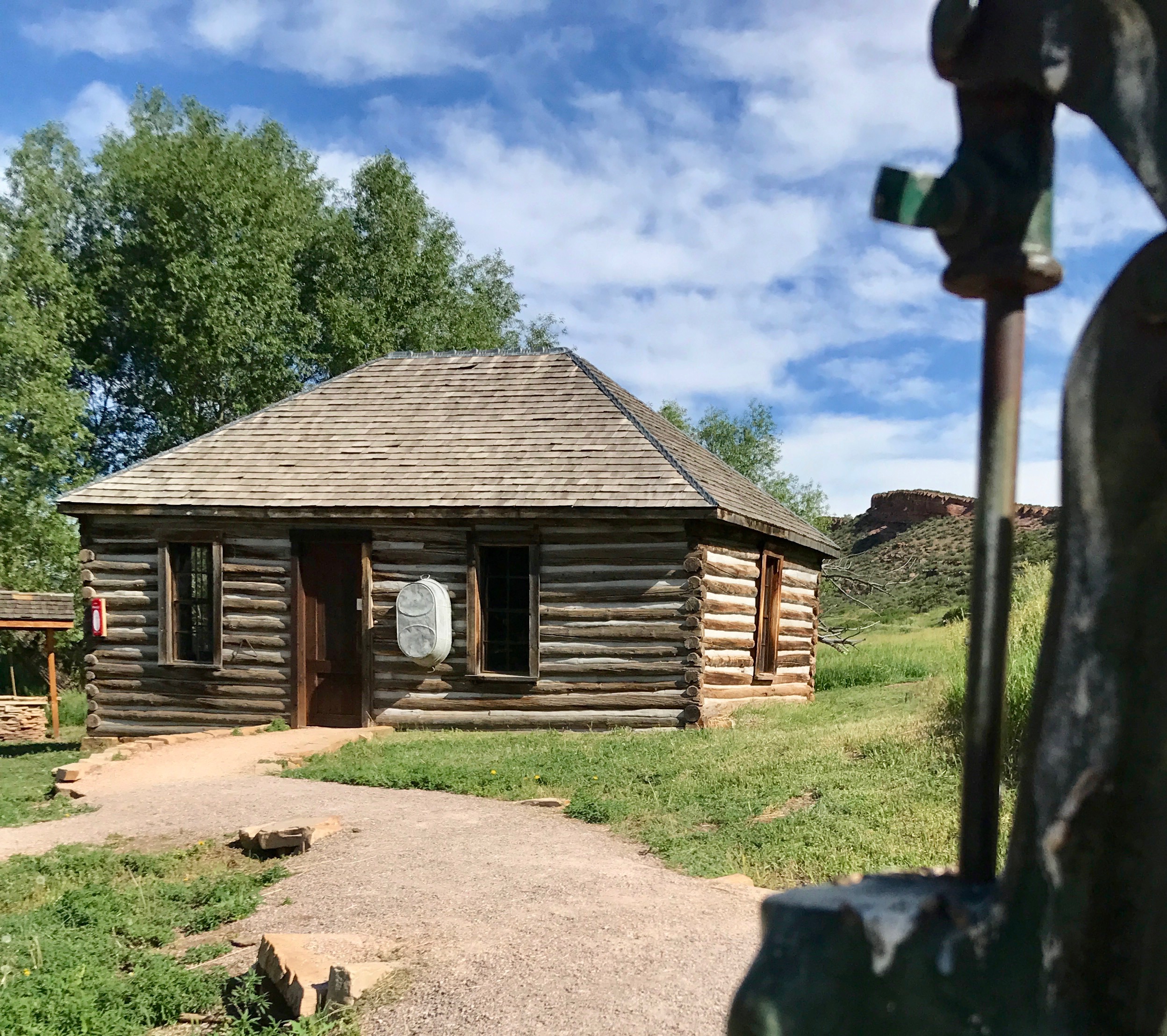
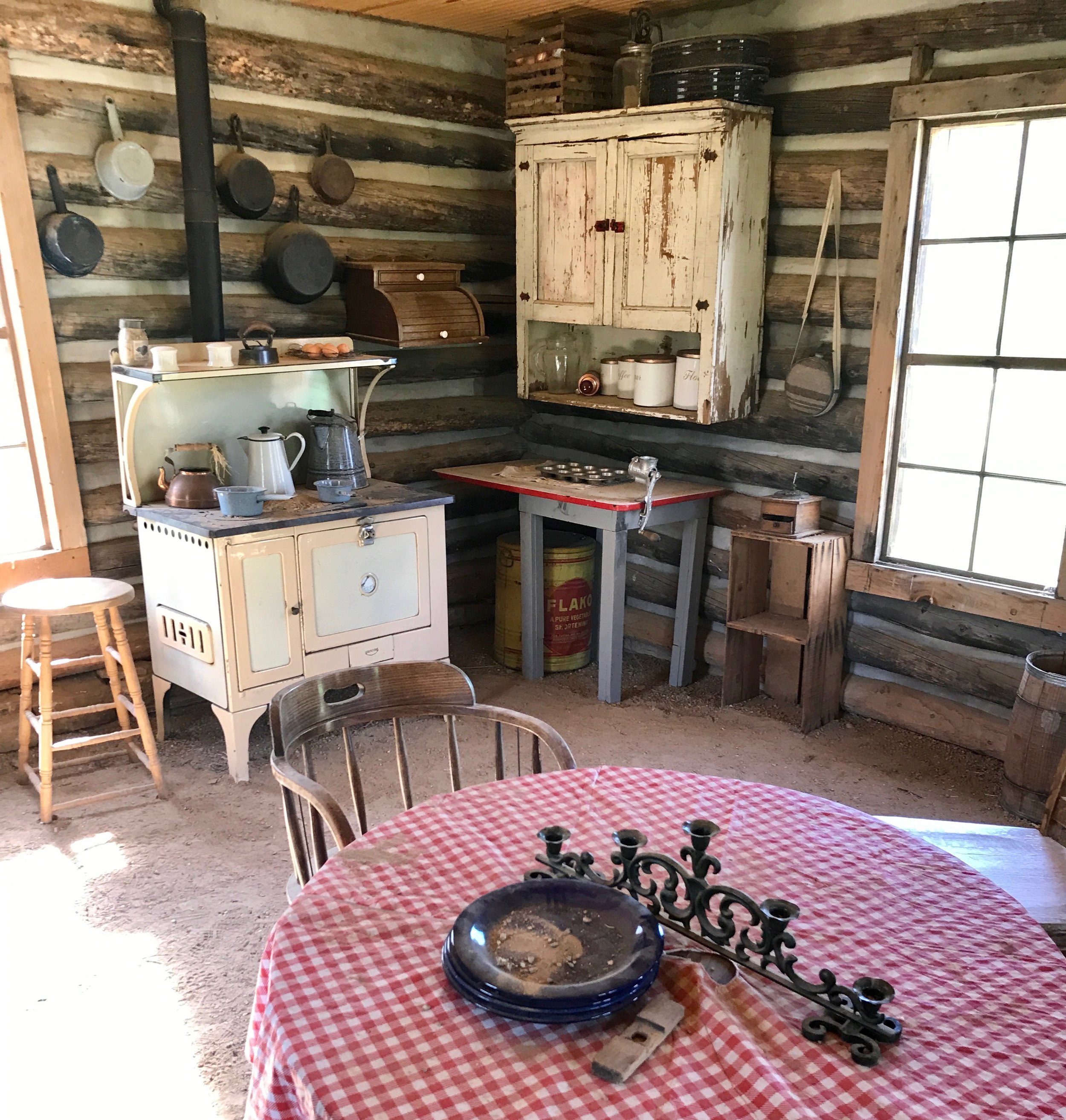
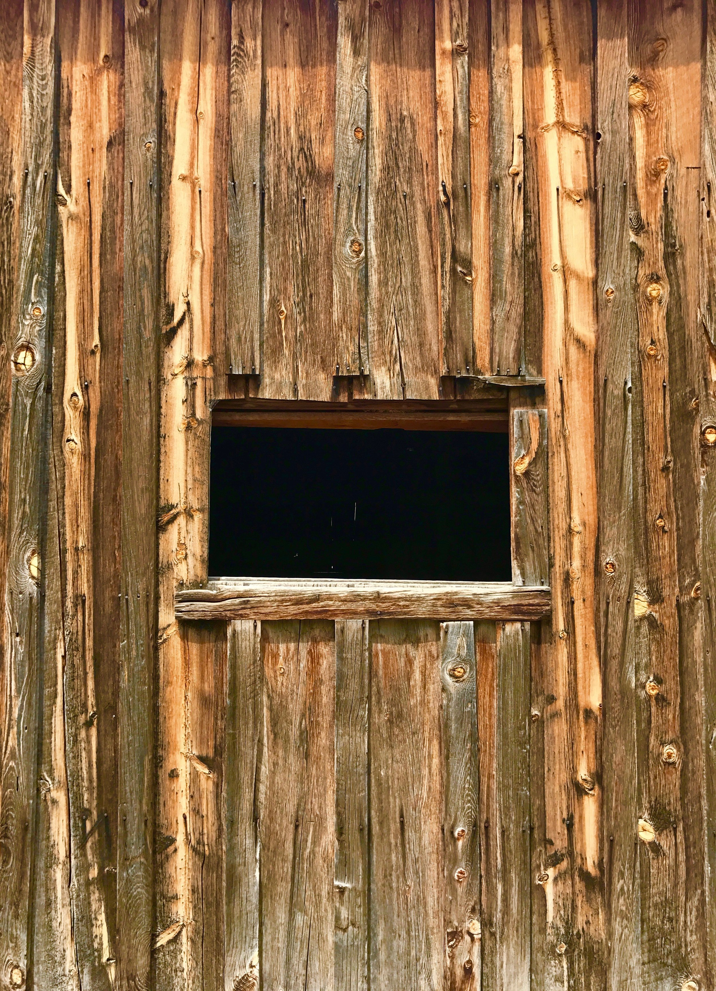
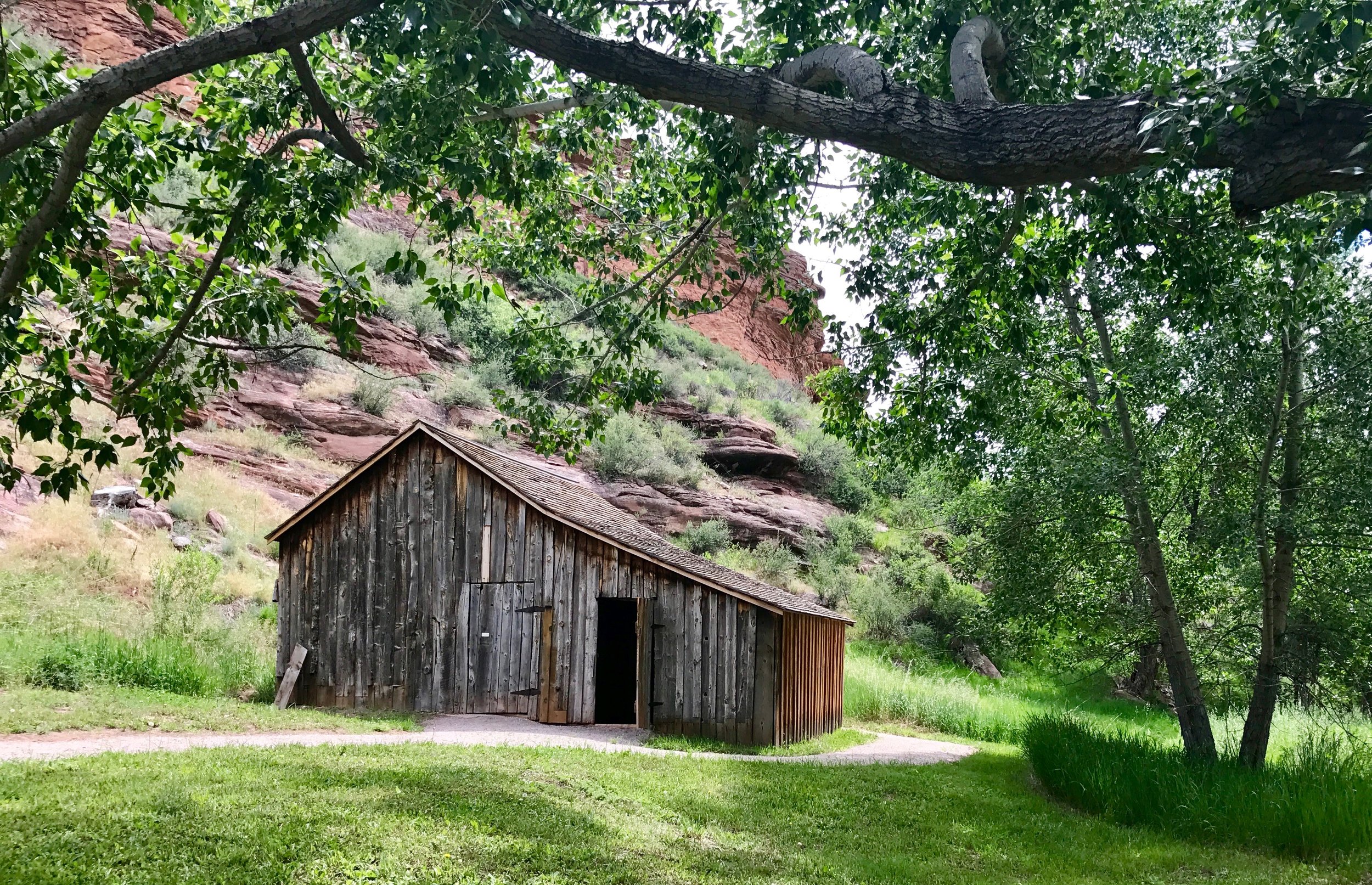
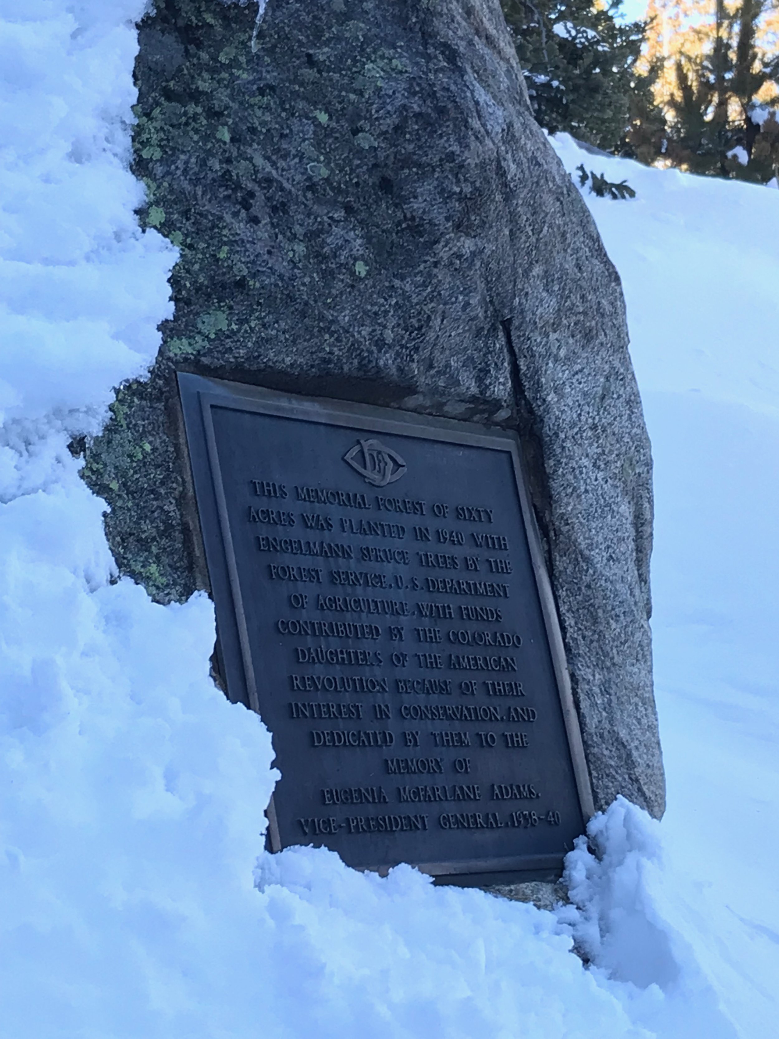
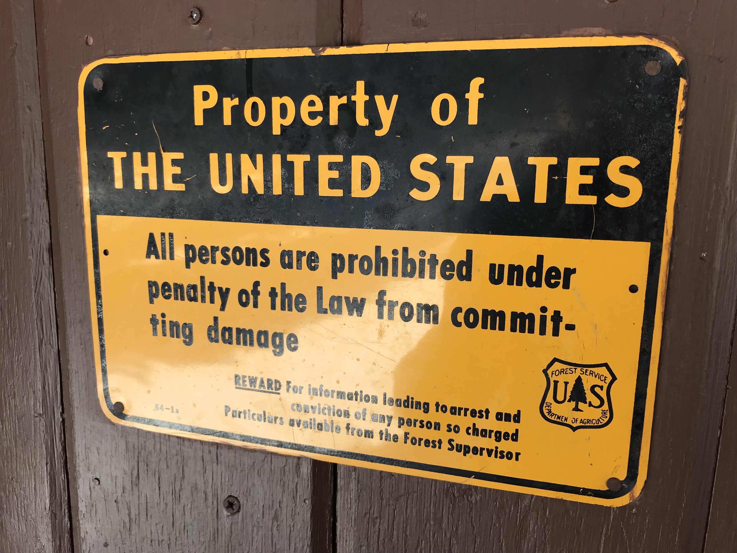
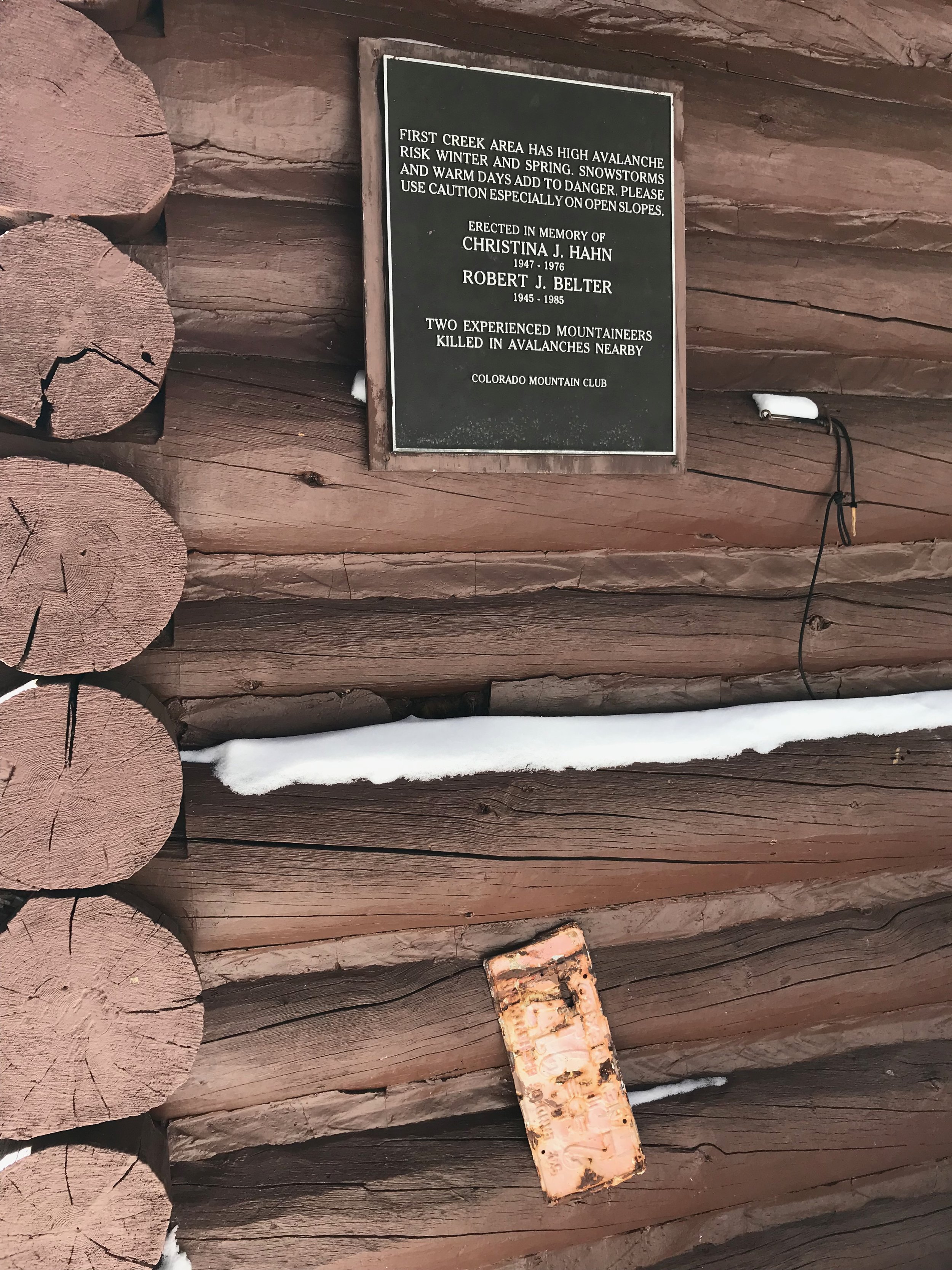
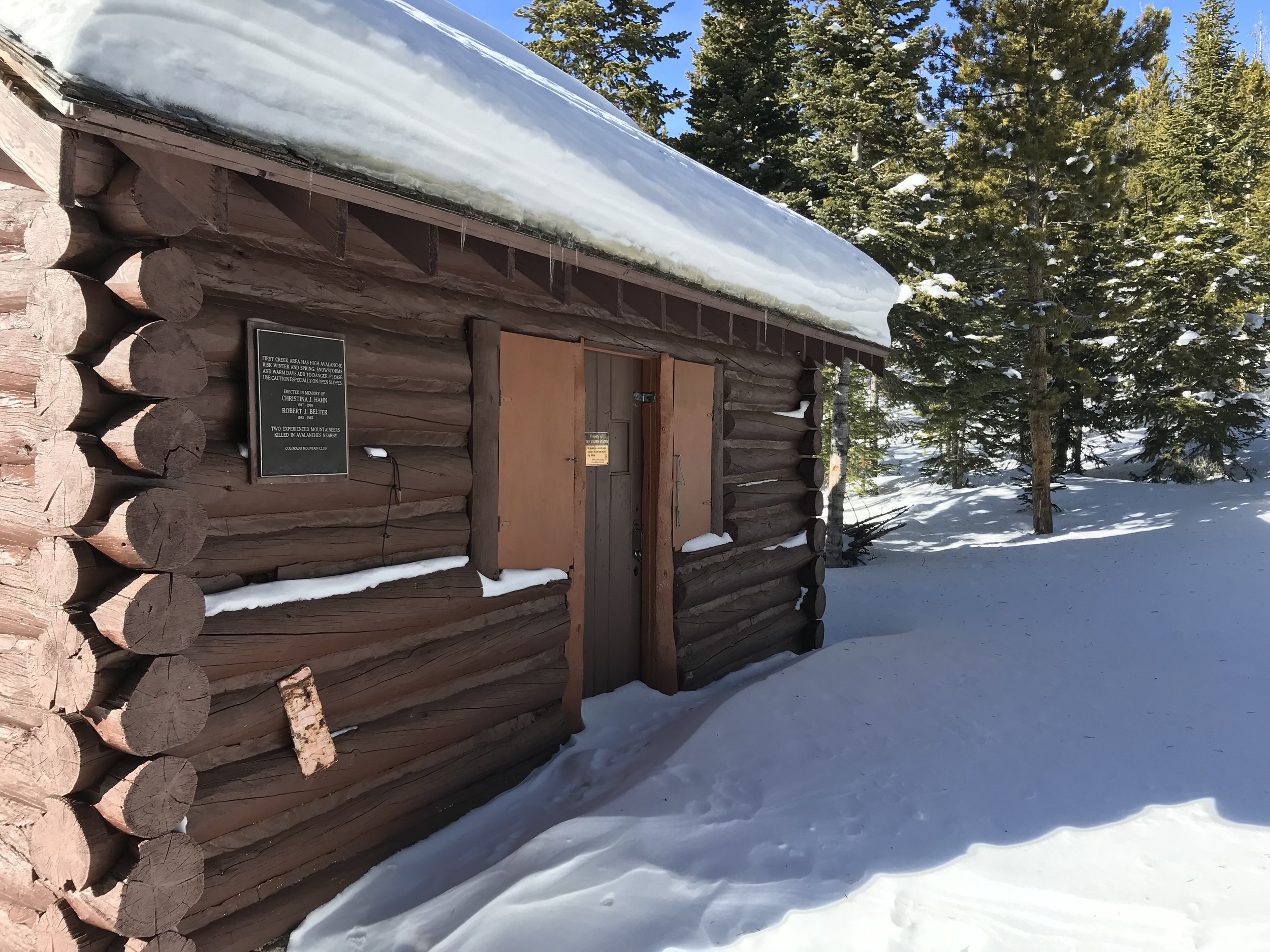
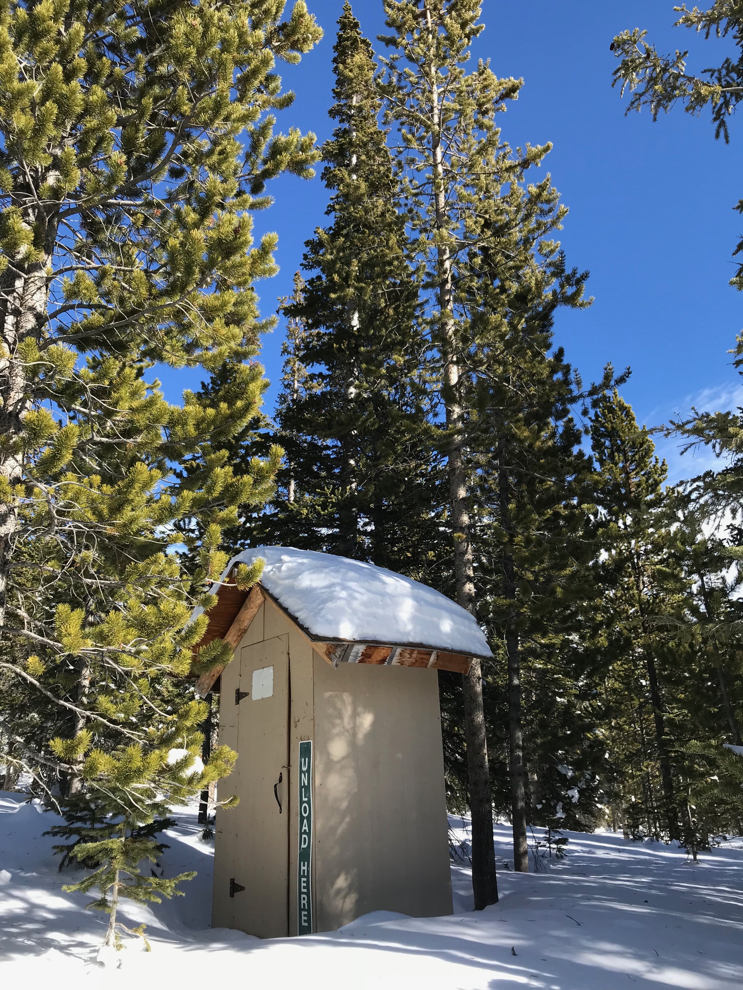
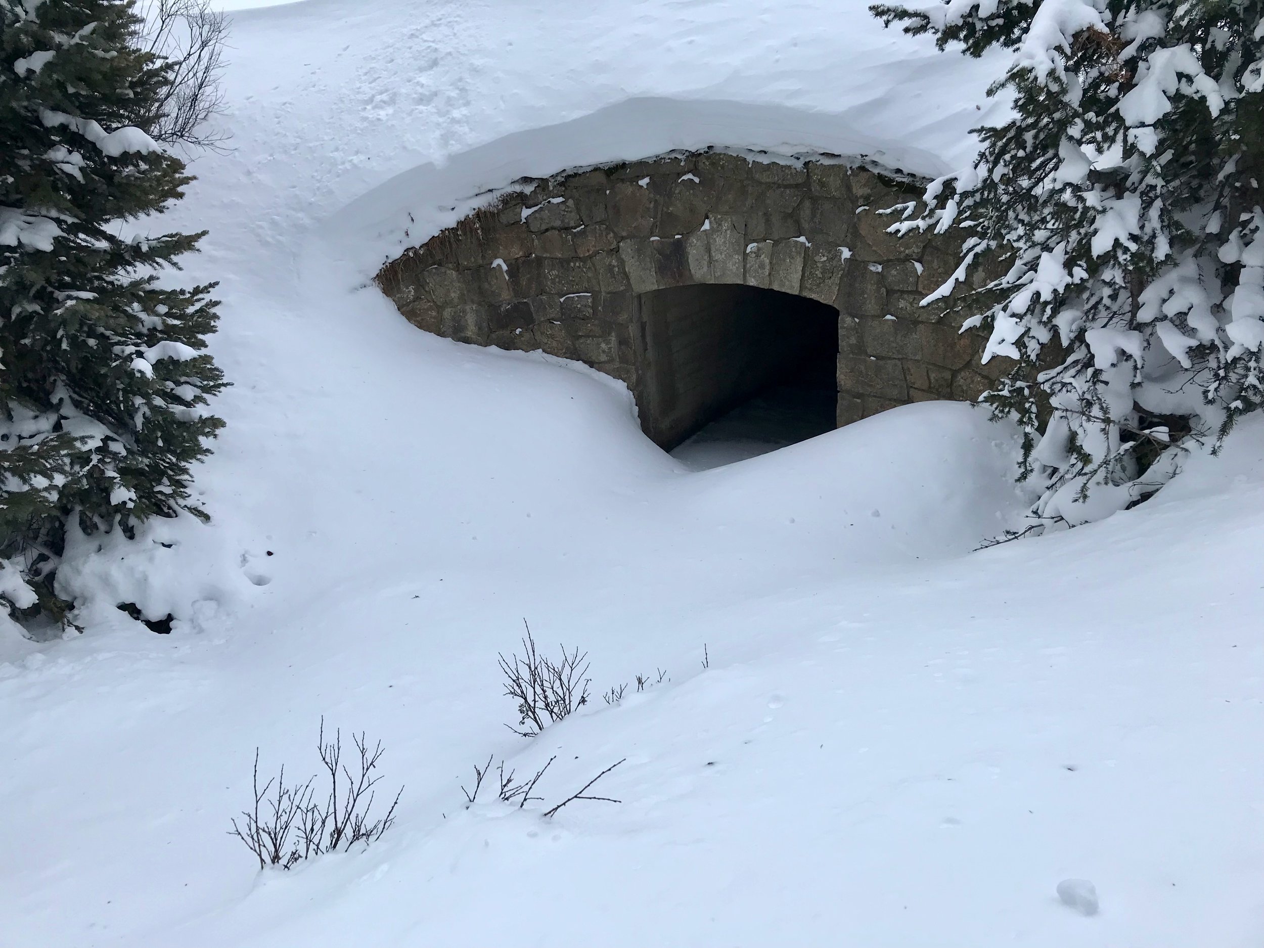
Eventually the steep terrain relented and we caught a glimpse of the wooden cabin through the pines. When I had last visited this place, smoke was puffing from the chimney and I heard the voices of some skiers enjoying breakfast inside. I had kept a respectful distance so as not to disturb their experience. This day, however, no one was home. I walked past the outhouse, and approached the log cabin directly. A closed door, covered windows and no tracks. In the dusky light that crept through the open door I could make out a dormant wood stove and a lantern hanging from a beam above a table. A few sleeping bags and blankets on a wall of sleeping platforms, some oils and spices in a pantry, and a dusty sofa filled the space. The mustiness of the place and the haphazard collection of items gave the cabin an eerie feeling. It was as though the last residents here were forced to leave instead of doing so by choice. I recall reading a June, 2016 news blurb about a man who had been charged for squatting in the cabin and charging others to stay with him. Perhaps these were his belongings, abandoned when authorities required him to leave. The First Creek Cabin used to be operated by the Colorado Mountain Club, but I exchanged correspondence with them and the club has not been involved in the cabin’s upkeep for several years. I wonder if the First Creek Cabin will fade into obscurity. The Broome Hut one drainage over and the lack of prime skiing in this drainage, direct backcountry explorers to other nearby areas. I would like to return to the hut again in a few years and see what its fate might be.

After sweeping up the snow that we had tracked in, Wembley and I retraced our path down the boulder-strewn slope, through the trees, and back to the banks of the creek. We returned to the parking area in the middle of the afternoon on a beautiful day to find one car: ours. It’s nice to know that even on busy days in the Colorado backcountry that a few places remain relatively unknown and unvisited. Let’s keep this one to ourselves.


Hidden History

Trail Running at Bobcat Ridge Natural Area

The trailhead at the Bobcat Ridge Natural Area, the site of an old farm, sits in the shadow of a steep sandstone hogback that cloaks its location until you arrive right at the entry gate. Hidden from the long open views of the interstate just a few mile east, the adventurers that find their way here have to be intent on finding it. Once there, the city of Fort Collins fully demonstrates its commitment to open space with generous services, programs, and accessibility for all visitors. I relish adventures that combine natural and human history and that's what I am hoping to find today. 

Starting out as a smooth ribbon of accessible pink concrete that leads to a large, modern, shaded viewing platform and picnic shelter, the trail gives way to crushed gravel for the first couple miles. Accompanied by the soundtrack of the prairie; Western Meadowlarks and Tanagers, I run under soft clouds to one of the most well-preserved cabins I've visited in the Rockies. Ed Kitchen built it in 1917 during his time as a sharecropper in the valley. The old structure has been thoroughly restored and stands open and free to tour with antiques and implements of the day filling the simple home.  From the cabin the trail traces an old ranch road through a broad valley bound on the right by a low ridge of scarlet sandstone and on the left by the low-angled foothills of Green Ridge. A chorus of crickets chirp around my feet as I continue today's run. The two-track shrinks to a winding singletrack. Smiling mountain bikers roll past on the undulating trail and I step aside to permit their passage.

The trail curls into the foothills above a small ranch pond and under old power lines, to a signed right-hand turn at the trail junction with the D.R. Trail. As the day warms I scout for rattlesnakes who like to sun themselves on the warm earth and fortunately do not encounter any during the day. Nor do I spot any of the area's namesake cats who at this time would be deep in the wooded areas resting before this evening's hunt. Instead I see innumerable butterflies including Variegated Fritillary, Weidemyer's Admirals, and Western Tiger Swallowtails dancing among the grasses and wildflowers. Here too I pass young ponderosa trees finding their way back after the Bobcat Gulch Wildfire singed the landscape in 2000. The City of Fort Collins only opened this area to recreation in 2006 and the trail here feels designed to the preferred specifications of trail runners as it drapes across ridges and ravines offering long views of the valley below. The trail meanders through cool riparian areas, limited respites from less-shaded stretches as the trail continues to ascend Green Ridge. The aroma of horse dung fills the air and sparks thoughts of the Old West. 

I am perspiring in the heat of the morning now and feel relief when I catch a slight breeze. The trail steepens as it climbs and a trailside sign marks the boundary of Roosevelt National Forest west of the city property. Mature ponderosa forest shades me from the fierce heat. Two hawks soar and circle on thermal currents overhead. This part of the Natural Area becomes increasingly wild, dipping in and out of gulches while continuing to gain altitude. In the heart of the old burn the naked, charred trunks of trees lead to a vantage above Mahoney Park. This  park-like basin of tall trees, and knee-high grassy meadows is ringed by humps of ancient pink granite and hidden atop the ridge, as it is, feels like a secret reward given the effort of the climb to reach it. Mahoney Park was a favorite picnic site for the couple that owned the land before the City secured it for the benefit of the public. I took advantage of this favored scene myself for a brief rest and snack before beginning the quick descent to the trailhead.

Turning away from the mountain oasis of Mahoney Park I follow a deeply-furrowed road leading back to the trailhead, At the bottom of the road a ring of stone marks an old Native American site used for either lodging or ceremony. Valley scenery passes by as I return to the crushed gavel and then the pink concrete from where my loop began. Back at the ranch, I explore the weathered corrals, barns, out-buildings and farming machinery that worked the land during it's heyday. Bobcat Ridge uniquely scratches the itch for both natural and human history and completely satisfied with today's adventure I am all the more pleased to know that there are more trails yet to explore at this special and hidden place.

Your Turn

Take I-25 North to Loveland and Highway 34. Folowing the course of the Big Thompson River through the community of Loveland leave civilization behind and turn North on County Road 27 also known as Buckhorn Road. One more left onto County Road 32 will shortly bring you to the Trailhead at Bobcat Ridge.

Peak and Plain Extra

Stop in downtown Loveland to get energized for the run with a "Velveteen Rabbit" at The Coffee Tree  or toast the end of the day with a Black Walnut Bourbon or Chai spiced Liquer at Dancing Pines Distillery.

Hey Big Chief!

Snowshoeing Chief Mountain

Though the celebration of the New Year was delayed by a day due to unexpected professional obligations, Maura and I loaded up the car with packs, snowshoes, water bottles, food bags, first aid kits, hats, gloves, coats, boots, the dog, and a thermos full of cocoa, and headed into the mountains. We quickly ducked away from Interstate 70 (knowing that today would be a big travel day on the popular mountain corridor) and steered south toward Evergreen then on up Squaw Pass Road to the trailhead for Chief Mountain. Chief Mountain offers a unique summit for Denver-based adventurers. Though thousands of feet lower than the high peaks of the region it still stands up tall by itself and provides 360 degree views from the Continental Divide to the Great Plains. It gets you into the alpine environment with a brief drive and a modest effort. In short, it is perfect for a New Year snowshoe adventure!

The trailhead, an unmarked though sizable pullout on the right side of the highway just past the turnoff to Echo Mountain Ski Area, can be tricky to catch if you haven't been to the trail before but once found, gaining the trail is a simple matter of crossing the two-lane mountain highway to what on this day happened to be a snowy ramp that lifts you over the road cut made by the highway and into the dense forest above. Along the open cut of the road the views come quickly, the rumpled Front Range foothills spreading below to the north and west. The highest peaks of the divide were obscured by clouds during our day on the trails so we did not get views of Longs Peak far to the North in Rocky Mountain National Park or of the summits of the Indian Peaks and James Peak Wilderness areas but higher on the trail we caught glimpses of area 14ers including Grays Peak, Torreys Peak, and Mount Evans.

But for now the trail stuck to the dense forest spreading over the north side of Chief Mountain. After a short but steep climb. we came to the junction with Old Squaw Pass Road, the route that preceded the new Squaw Pass Road, also known as Colorado 103, our smooth asphalt path to the trailhead. The Old Squaw Pass Road is relatively flat and, if accessed from one end or the other can be skied as an easy 8-mile out-and-back. The Chief Mountain Trail, continuing up from the old road grade is quite steep if you are on skis, but our snowshoes were just right for the journey. Wembley, Maura's Australian Shepherd, had on his new snow booties, an accessory to which he has become reluctantly accustomed to despite it's far-more-slippery surface when compared to his native paws. Continuing our steady climb, we made adjustments to our many layers of specialized apparel to stay warm without overheating and comfortable without getting cold, a balance that requires experience to get just right on a day like today with the combination of weather and exertion which we encountered. Another junction lay ahead and we discovered the right route after being greeted by some other snowshoers and dogs making their way down. More time in the woods led to one more switchback whereupon the setting of the hike changed drastically. Treeline. As the stunted trees gave way to barren rock, and windblown snow, the grade of the trail further steepened. This added pitch, though intimidating, was tempered because the final summit block came quickly into view. Due to the violent winds that assail Chief Mountain, the trail here was mostly dry. We dropped our snowshoes and placed them off the side of the trail to collect them on the way back down, and proceeded with just our winter boots. We also removed Wembley's booties who celebrated with a vigorous sprint through the tundra. He loves the snow and his sprint was occasionally interrupted with a face-first plunge into a snowdrift followed by a belly-up wriggling, the closest he can get to making snow angels. They look more like snow holes. One more long switchback  brought us to a small grove of bristlecone pines, trees known for their stout resistance to death in extreme conditions and some of the oldest living things on Earth.

The summit block required a tricky scramble, but on top the reward was plain to see. The nearby summit of Squaw Peak with it's summit fire lookout and radio antennas squatted to the East, the broad shape shielding an open view back to the metropolis of Denver. The historic profile of Pike's Peak, America's original "purple mountain majesty", stood grandly above the haze to the south. Facing west, the high slopes of Mount Evans, it's paved road slashing the east face seemed close enough to touch! And back to the north, under a low ceiling of cloud cover, the foothills, stacked up against the snowy flanks of the peaks of the Continental Divide. Somewhere below, the old mining town of Idaho Springs was tucked into the valley of Clear Creek.

The wind, while not screaming past on this day, still chilled us while we took in the view so we retreated from the summit and found a seat among other rock outcrops where we could treat ourselves with some hot chocolate and treat Wembley with a few liver-bits. With the kind of satisfaction only experienced after reaching the top of a wild mountain, we shouldered our packs once more for the trip down. We retraced our steps to our snowshoes, but rather than strapping back in, we decided to stow them on the outside of our packs as the footing in the softened snow was safe.  After a couple switchbacks we spotted a glissading track descending straight down from the trail that we had noted on the way up. To Wembley's confusion we plopped down on our behinds and slid along the luge-style furrow, whooping all the way until intersecting the trail far lower down the mountain. The shortcut provided a shorter and extra-fun option on the way out. Gravity further helped the rest of our effort and we quickly returned back to the trailhead where we piled back into the Subaru for the trip back to civilization. We both agreed that the day on the trail was perfect. Chief Mountain combines challenge, wilderness, and proximity into a unique experience especially ideal on days when you are short on time or when the trip to ski country is bound to be overcrowded.

Of note, Echo Mountain Ski Area, just below the trailhead has gone through many revolutions in its history. Initially known as Squaw Pass Ski Area, its hey-day faded after the completion of the Eisenhower and Johnson tunnels on I-70 in 1973 made it easier for folks on the Front Range to get to Breckenridge, Copper Mountain, and Vail. After its most recent stint as a private ski area for ski race training, it is now opening again to the public. As I write this post the area is getting hit by a big storm that should allow it to open on time for the 2017ski season. I'd like to try this local spot out, enjoy the history of the place, and support a mom-and-pop destination that doesn't get the attention of the higher-profile options farther West.


Your Turn

To reach the trailhead, leave Denver on Interstate 70 and continue to exit 252 for Evergreen/Colorado 74. After about three miles, turn right at the light, on to Squaw Pass Road/Colorado 103. Begin looking for the pullout on the right side after 12 miles on Squaw Pass Road. This is just after the road turnoff down to Echo Mountain Ski Area. A new sign marks that Echo Mountain turnoff making it much easier to identify.

The trail can be found on the south side of the highway opposite the pullout trailhead. It is located nearest the eastern end of the pullout and heads up from there.

Peak and Plain Extra

Toast your adventure at El Rancho Brewing Company, a resurrected restaurant and event site located near the junction of Interstate 70 and Colorado 74 on Rainbow Hill Road. You can feel extra pleased while guzzling your I(70)PA india pale ale and chowing down on sweet potato tots because each year they host a fundraiser, Brews for Rescues, complete with the exclusive "Gone Astray IPA", for the Alpine Rescue Team, the folks who may come and save your butt if you run into trouble up on Chief Mountain. Cheers!

Southern Spin

South Denver Bike Loop

I recently gave the running legs a break with a road bike ride through southwest Denver linking together several bike trails for a diverse 30-mile loop. Across the street from the Regal Cinema at River Point I turned right onto the Bear Creek Trail (BCT) and set off along the narrow twisting concrete towards the western foothills. Before making the right turn I noticed ahead the bridge that I'd come back across to finish the ride. Rusted barbed wire and and industrial metal fencing along the trail contrasted with the grasses and overhanging trees along Bear Creek's gently flowing waters. Several clatter-board bridges span the creek in this early section with relatively tight turns. Broken Tee Golf Course's rolling fairways lined the left side of the trail. The first tricky route finding happened at about 1.5 miles where the route intersects South Lowell Blvd. Pausing to look for oncoming traffic I  turned left (south) onto Lowell to pass over a bridge with an immediate right after this bridge to continue on the BCT. To the left I passed the well-kept athletic fields outside Mullen High School and entered into Bear Creek Park over another bridge. The route ducked under US Hwy 285, then Sheridan Blvd, and passed into the Bear Creek Greenbelt under another overpass at Wadsworth Blvd where the prairie dogs living trailside greeted me upon my arrival. On the far side of the Greenbelt (5.3 miles) I stopped at the Stone House in Lakewood Park, a uniquely constructed 19th-century home listed on the National Register of Historic Places. I followed a metal-blue dragonfly back to the trail where it resumed its westward direction by passing under Estes Street. Knowing about another tricky bit of route finding on the approach to Kipling Street I was sure to stay left at the junction, crossing over a creek bridge and then taking a right at the next junction to pass under the road grade elevated above. Not long after a right at a T-junction followed by a left to continue heading west got me around Kipling Parkway. Winding on behind condos and then curving right along the edge of the Fox Hollow Golf course, the most challenging route finding was done.

At the crossing of Fox Hollow Lane (7.3 miles) the path continued to the left paralleling the two-lane road to the Fox Hollow Golf Course. I slowed near the clubhouse of this public golf course to avoid any collisions with golf carts heading from to the tees. Here the trail picked up a wide road shoulder and began a gradual climb up towards the Mount Carbon Dam. Small, energetic birds flitted in and out of the sheltered area around the dam's outflow and the broad treeless earthen mass of the dam created a surreal landscape along this section of the ride. The biggest, steepest climb of the route proceeded by winding between the fairways and greens of the Homestead Golf Course to the top of the 250 foot climb. After huffing and puffing to the top I was rewarded with long views out to the foothills, back to the skyscrapers of downtown Denver, and upon Bear Creek Reservoir below. There are restrooms here as well as complimentary water. Back to the trail junction at mile 9.8 I held on for a windy and speedy serpentine descent into the open prairie of Bear Creek Lake Park. An unmarked junction at 11.3 miles signals a left turn that had me climbing again to cross over route 285 and out of the park to the C-470 Trail. The sidewalk alongside Home Depot on Eldridge Street led across Quincy Avenue and past power lines and prairie dogs.

Now on the C-470 bikeway I was sandwiched between Eldridge Street and the busy Hwy C-470 climbing steadily to Tipsy's, a Walmart-sized liquor outlet and a road crossing at Bowles Ave. The trail here begins descending and zooming along like the traffic on adjacent C-470. I searched for hawks above the hogbacks on the other side of the freeway here, but hardly had time to look up as I whizzed along on the smooth concrete. I was fortunate to catch the light at Kipling Avenue where the rest of the route continued as uninterrupted bike path all the way to the finish. Cresting a hill, the summer heat tempted me to stop for a refreshing break at Deer Creek Pool, a public facility of the City of Littleton with direct access from the trail. Big views across Chatfield Lake, filled with boaters on the day I passed by, offered more temptation to pedal a few extra miles for  a visit to the swim beach. Instead, I soldiered on with my sub 2-hour goal in mind. The trail ducked away from C-470 to pass through the tunnel below Wadsworth Blvd. Another short climb and a descent to a left-turning pigtail kept me on track for the tunnel under C-470 (if you hit asphalt instead of concrete you've overshot this turn). that brought me into Chatfield State Park. Staying left, the trail passed heavy concrete flood control structures engineered to prevent South Platte River flooding and I enjoyed the straight away descent beside the river to a Y-junction shaded by cottonwood trees. Again staying left onto the Mary Carter Greenway I pedaled under a bridge and scooted a round-about entering the busiest segment of this road ride.

Threading between Eaglewatch and Redtail Lake, the trail became very scenic for the next couple of miles passing through South Platte Park and by the Carson Nature Center. The lakes offer opportunities to birdwatch, fish and relax not far from the bustle of downtown Denver. I was especially cautious and mindful in this area considering all the other trail users including joggers, runners, many cyclists, and even families with baby strollers. There is a 15mph speed limit on the trail and roundabouts to slow competitive riders. There has been at least one fatal accident between two cyclists on this section of trail so be careful when in this area. A couple miles up the trail I saw the large barn at the Hudson Gardens and Event Center. I highly recommend stopping off at the trailside Nixon's Coffe House here for a pit stop. Fresh smoothies or a light lunch make a great compliment to this day touring the outskirts of Denver. Hudson Gardens is free to visit and features beekeeping, herb gardens, rose gardens, Victoria Water lillies, vegetable gardens, aquatic plants, a water garden, and my favorite garden: the conifer grove. But the best part of the place, not far at all from the bikeway is the Garden Railroad, an outdoor model train set running through a landscaped slope of tunnels, landforms, and native plants.  From Hudson Gardens I crossed over to the west side of the river as soon as  I could find a bridge and spun out a few more quick miles back to the starting point enjoying the downhill grade and keeping an eye out for paddlers and stand-up-paddle borders at the Union Chutes and another eye out for errant golf balls as I passed back through the Broken Tee Golf course in the final mile of the ride and over one last bridge back to the movie theatre. This ride really is an outstanding tour on a summer day with plenty of unique options to enrich the experience along the way.


Your Turn

The South Denver Bike Loop is challenging based only on its distance which can be broken up by many diversions along the way to permit rest and leisure. Plan at least a half-day if you want to stop at the Stone House, Deer Creek Pool, and Hudson Gardens. Check the websites for hours of operation. The trip over to the Chatfield Swim Beach would be an extra 3 to 4 miles there-and-back. If riding this route with no side trips or stops expect to take between two to three hours on a road bike. Bear Creek Lake Park also has wildlife, trails, and a swim beach to explore on this loop. Of course, you can finish your ride recovery with a visit to the cinema at which the ride begins and ends. It has air-conditioning after all.

P&P Extra

Replenish your carbohydrates with breakfast at Lucille's Creole Cafe. The Eggs Sardou (creamed spinach, gulf shrimp, and hollandaise) will instantly transport you to the French Quarter and the buttermilk biscuits with house-made jam will fill you up for the rest of the day. Eat it guilt-free after pedaling about 28 miles to get there! If you want to include this on your loop, stay on the bike path that keeps to the east side of the South Platte River after leaving Hudson Gardens until you reach the restaurant at Bowles Ave. You can still cross back over to the west side after leaving Lucile's. It is located at 2852 West Bowles Ave, Littleton, CO 80120. 303-797-1190


Where the Buffalo Roam

Hiking Rocky Mountain Arsenal National Wildlife Refuge

In March 2007, while many Denver-ites celebrated their Irish-ness, guzzling green beer, the heavy hooves of 16 bison churned into the dirt ten miles east of the city center. These were the first bison to set foot here in over a century. Their return was made possible by the efforts of the US Fish and Wildlife Service and Shell Oil Company as part of a US Army chemical manufacturing site restoration now called the Rocky Mountain Arsenal National Wildlife Refuge (RMANWR). On maps of Denver, the Refuge fills a surprisingly large block of green color northeast of downtown. Twenty minutes or less from almost anywhere in the city, the RMANWR allows hikers like me to sample the great outdoors with a quick escape, and to feel even more connected to the wild by viewing the small herd of bison that has prospered here since their St. Patrick's Day arrival.

I started my visit to the Refuge at the Pat Schroeder Visitor Center just inside the southwest entrance. The newly constructed building has the requisite gift shop, auditorium, and museum, familiar to most visitor centers. The exhibits in the museum revealed a surprisingly rich history to me, from its earliest paleoindian inhabitants, to the subsequent evolution that includes time  as a homestead for immigrant farmers and ranchers in the 1860s, a US Army chemical weapons manufacturing facility in the World War II era,  one of the worst EPA environmental disaster sites in the 1970s, and a diverse restoration effort in the 1990s to become one of today's largest urban National Wildlife Refuges. The visitor center also has a little desk staffed by volunteers that told me where I might best see the bison. After getting the update at the visitor center I took time for the short scenic drive into the bison pen. Just after passing through the gate in the 10-foot high wire fence I saw a collection of mule deer grazing in the fresh springtime forage, their namesake ears having no doubt heard me coming long before I spotted them. At the next turn and within twenty yards of the road I came upon the herd of about 30 visible bison. Shaggy of fur, sharp of horns, and with a nonchalant demeanor, the beasts leisurely browsed through the prairie. From the safety of the car I could snap a few photos and observe the behavior of these large inhabitants of the plains and symbols of the West. It's good to have them back after a long absence.

Turning off a side road from the wildlife loop I stopped at the "contact station", a name as utilitarian as its design, where a parking lot served as a trailhead to multiple different trail loops. My own hiking route led down a freshly-burned embankment to the cattail-ringed shores of Lake Mary. After circling the lake, the Prairie Trail meandered through a large water diversion culvert, under some high-tension electrical wires, and up to higher ground, a grassy expanse that served as a home for curious and communicative prairie dogs.

Tall clouds piled up above in the western sky while smaller clouds of mosquitos swarmed around my head, though I seemed to remain generally bite-free. Perhaps it was the easterly prairie breeze that kept the mosquitos at bay. The same breeze held two distant raptors aloft, circling, their keen eyes certainly seeing me more clearly than I could see their forms high overhead.The prints of deer hooves in the soft dirt led along the same trail that I followed.  Oddly-shaped and mysterious concrete forms lay sporadically off this section of the trail, a remnant of some unknown past use here; now one more secret of the Refuge. Perhaps they marked the course of an old ranch road or maybe parts of the structure of a cold-war bunker.

After about one mile, A short wooden-and-rope bridge spanned an irrigation ditch and then the trail crossed pavement to a segment that became more abandoned roadway then single-track dirt trail. This stretch of the hike traversed intermittent groves of shaded sumac tree yet to leaf in for the season. The butterflies seemed to like these thickets as I began seeing them in great numbers here. One, a small white butterfly flitted left and right before me with what appeared to be great effort. A larger black butterfly paused for a brief rest on the ground ahead of me before continuing on it's afternoon travels. The trail passed a square meadow surrounded by neatly placed cottonwood trees that, on past visits to the refuge had sheltered herds of deer, though on today's visit none were to be seen. A red-breasted robin flew from the ground to a  a nearby tree as I approached. Perhaps more than any other bird, the robin symbolizes spring for me, and its presence assured me that winter was quickly ending here on the Colorado plains. The whole trail  through the refuge in fact was resplendent with bird life. No silence on the plains here with all the lively bird calls filling the air with cheerful melody.

Here the landscape rose and fell like a swelling sea, undulating with swales and hummocks carpeted by tall grasses rustling in the air. Ducking again into sumac shrubs the snapping sound of fleeing grasshopper wings smacked in the air as they leapt away from my passing. I was approaching a wetland, the farthest point of today's hike, and the croaking of frogs began to enter my awareness. At a deep puddle off came my shoes and socks followed by an ankle-deep wade to access the bird blind set in the marshy soil beside the ponds. Through the openings in the wooden wall of the blind I spotted American coots, their white faces and dark bodies bobbing on the surface of the pond. Mallards, and other ducks also criss-crossed the pond. A white-tailed deer bounded away from the shore. This idyllic scene alone was worth the effort it took to reach this place. And on the outskirts of a community of two-and-a-half million people, I had it all to myself.

On the way back along the trail, I was reminded of my proximity to the largest city between Chicago and Las Vegas. Emergency sirens wailed, the roar of airline engines screamed overhead, high-tension wires criss-crossed the view, and I could spy manufacturing centers and warehouses through the trees to the south. Still, my immediate surroundings felt wild. I turned right down a segment of trail that had been closed since recent floods, a quarter-mile stretch along an old road. The terrain was easy to traverse by foot and I was uncertain about why the trail had been closed to public use. Dry leaves crunched underfoot, and an unsual red-orange grasshopper sprang along in front of me for a few minutes as if showing me the best way through this section. The trail again crossed a road and picked back up along the shore of Lake Ladora. Above the water a red-winged blackbird chased a companion through the air. Across one arm of the lake, the trail used a floating bridge above the lake.

The wind shifted and now the western clouds heaped up and darkened in a way that threatened to unleash a torrent of rain. In the distance virga, a phenomenon that occurs when falling rain dries up before it reaches the ground, hanging like a natural curtain. The looming clouds raised concerns that I might finish this hike with a soaking. In the distance an old farmhouse and windmill stood as another reminder of bygone eras at the Refuge. The air absolutely filled with trills, tweets, whistles, chirps, and twitters from it's winged residents as I looped Lake Ladora back to the trailhead. Back at the contact station, I dove into the car just as raindrops began splattering from above. The short drive through the rain back past the visitor center and to the Refuge's exit returned me almost immediately to the surroundings of the urban landscape. The transition jarringly contrasted the natural landscape that I left behind in the Refuge. There wasn't disappointment with the change however. Rather, I felt thankful to have a place so close to home to be immersed in the kind of wildness that comes with big skies and bird song. And roaming buffalo.

Your Turn

The RMANWR is open from sunrise to sunset 7 days a week (closed on Thanksgiving, Christmas, and New Year's Day) but the visitor center is only open from Wednesday to Sunday from 9:00 AM to 4:00 PM. As a National Wildlife Refuge, Rocky Mountain Arsenal limits some activities including, biking, running, pets, and hunting. Fishing is allowed on Lake Ladora and Lake Mary and requires a Colorado fishing license and an additional RMANWR permit  ($3.00 at the contact station). Occasional tours are offered by park staff. More information is available by calling (303)289-0930.

P&P Extra: 

On adjacent land that was once also a part of the US Army site, the community of Commerce City built a sports stadium that is now home to the Colorado Rapids professional soccer team. The site has also hosted rugby and lacrosse events and occasional music concerts. If planned well, you could follow your visit to the refuge with rooting for the home team during an exciting Rapids home game at Dick's Sporting Goods Park and have an "only-in-Colorado" experience.