Lay of the Land

Downtown Denver

Instead of heading out of the city for today's adventure I headed into the heart of it. The REI Flagship store is ideally located for urban adventures of all kinds, be it a bike ride along urban trails, a playboating session on the South Platte, an afternoon of park lounging and frisbee or, like my plans today, a walk around some of Denver's most unique urban landmarks.

On my way to 15th Street from the parking lot, I passed by My Brother's Bar, the oldest bar in Denver, with a quirky history that includes serving as a hangout for beat-era personalities like Neal Cassady and Jack Kerouac. If you can't resist the aroma of the charred burgers and the relaxing melodies of classical music, stop in and try a Johnny burger on the shaded patio.  A short ways down 15th Street I followed a trail above the western bank of the South Platte River north through Commons Park and then crossed the pedestrian bridge over the river into the open green space of the park. Ahead, the angled white "mast" of the Millennium Bridge projected high above street level, a web of suspension cables reaching down to support the pedestrian bridge, a first-of-its-kind design. Up and over the rail lines coming into the newly refreshed Union Station, I admired the futuristic elegance and traditional architecture blended into the new transportation center, a terminus for light rail, passenger and freight trains, and regional bus lines..

Passing the Tattered Cover bookstore on Wynkoop and 16th, I considered stopping in to peruse the shelves of local Colorado books and national bestsellers, but resisted the urge and instead ducked in to see the new lobby of the Crawford Hotel which now occupies the original Union Station terminal. It has retained much of the authenticity of the original space but has updated it to serve as a modern hangout for both guests and locals with bars and dining options off the spacious center room.

Back on Wynkoop I walked up to 19th which offers open views of the brick and steel edifice of Coors Field, home of the Colorado Rockies professional baseball team, and a fine place to spend a summer afternoon, whether you're a fan of baseball or not. Seats along the first base side or those to the general admission area of in-stadium bars and lounges serve up outstanding Front Range views in addition to refreshing cocktails and cold beer. The course from 19th to Larimer led past the converted warehouses, filled with loft apartments, unique art studio spaces, and retailers that define the Lower Downtown (LoDo) neighborhood of Denver. Larimer Street at 16th Street leads into Writer's Square, a compact collection of shops and restaurants worth exploring. Today I stopped into Rocket Fizz, a whimsical Candy and Soda shop where I discovered some unique candies from other countries, a few nostalgic treats from my childhood (remember BUN candy bars from the Bozo Show?) and a cold Cherry Cola from Sprecher, a hometown (Milwaukee) soda and beer maker. Fueled with sugar for the miles ahead, I continued along Larimer Square, a few festive blocks lined with more boutique shops and fine dining.

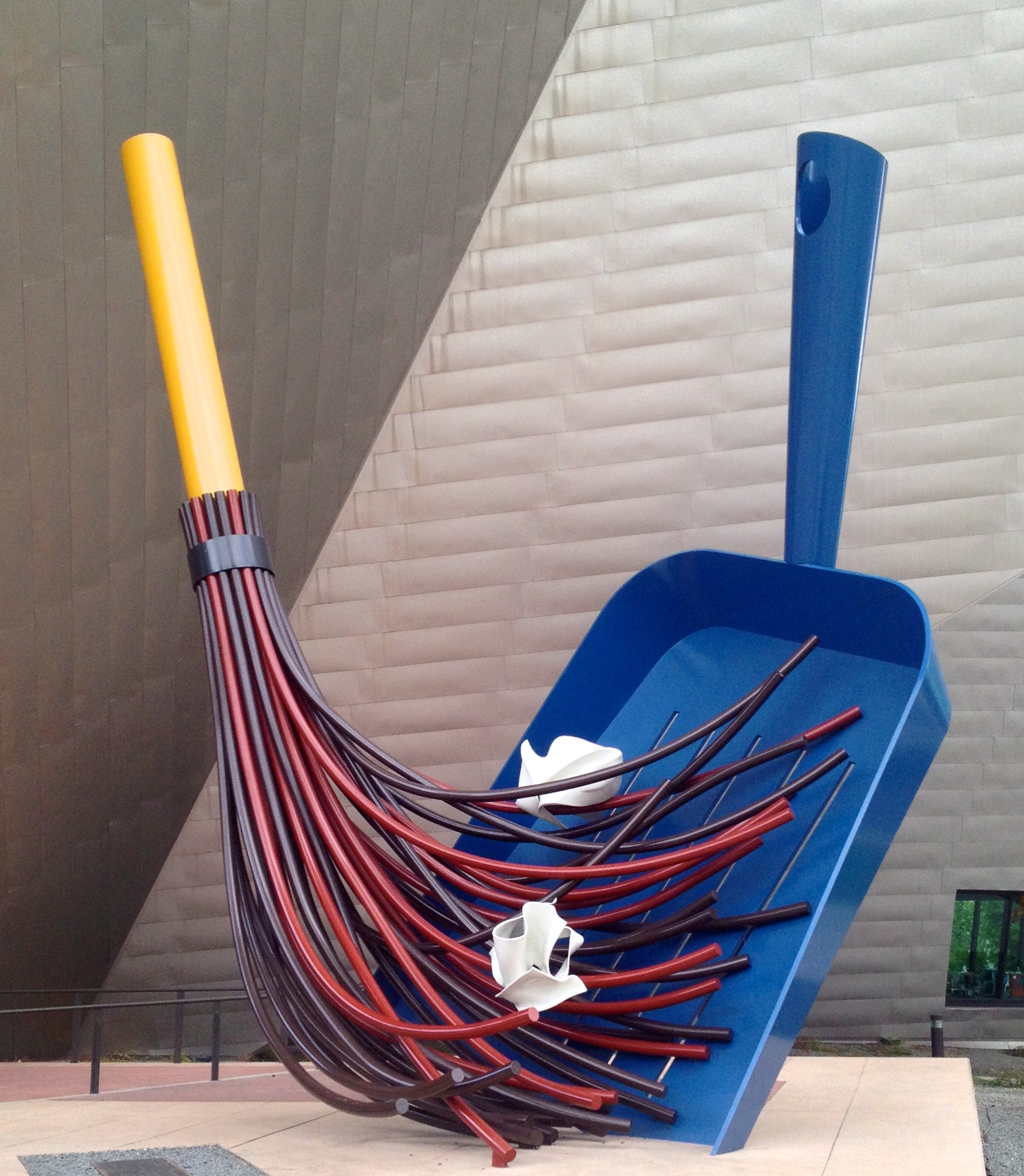
A left on 14th Street led away from the shopping district and toward the performing arts area of Denver. I said "hello" to my favorite part of the large Arts complex and Colorado Convention Center, the giant blue bear sculpture ("I See What You Mean, 2005") peering into the windows to see what this week's conference-goers were up to. 14th street connects to the main governmental center of the city, county and state at Colfax which I crossed over to walk along Bannock Street. The grand marbled buildings of the City and County Building stood to one side of my view with the Capitol, gleaming in its gold-leaf encrusted dome, stood opposite up the hill and across the flowerbeds, open lawns, and stone structures of Civic Center Park. The Park serves as a city commons for rest, protest, and a variety of events and festivals for state citizens throughout the year. I curved around the edge of the park, again on 14th and took a slight detour to peek at the hidden murals of one of my favorite Western artists, Allen Tupper True, at the Greek Theatre. If you can find the murals, I think you'll enjoy the painted scenes of Western motifs too.

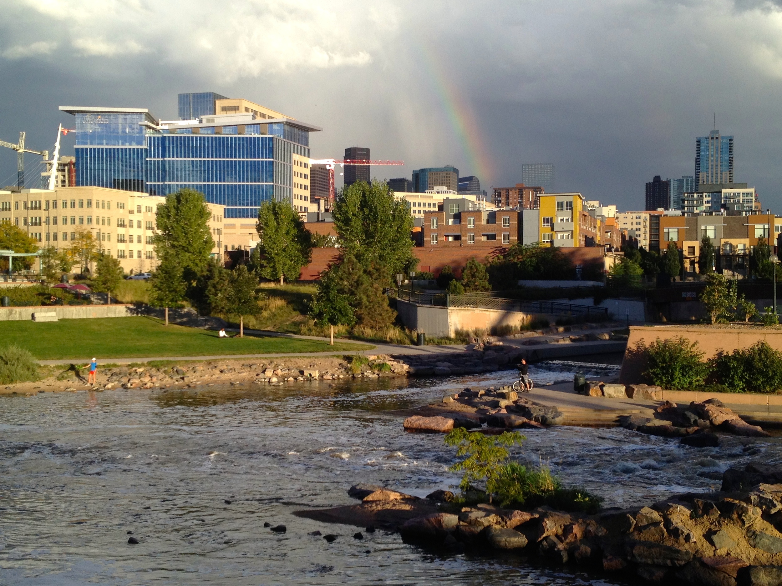
A brick promenade leads South from here with the unusual architecture of the Denver Art Museum and the Denver Public Library's Central Branch flanking the route. Both the library (free) and the art museum (admission fees) are worth exploring if time allows. I continued South on Acoma Street, hung a right on 8th and then another quick right onto Speer Boulevard. I crossed into the center of Speer where, below street level and between the wide lanes of this thoroughfare, Cherry Creek and the concrete multi-use path that runs alongside it serves as a direct conduit back to the starting point of this route at REI. Cherry Creek is used by many cyclists for recreation or commuting so be sure to use caution when walking along this shared path. Back at the starting point, I looked back to the East and was treated to a perfect view of the Denver skyline with a vivid rainbow in front of clearing stormclouds. The rainbow was a perfect capper to this urban adventure and though there wasn't likely to be a pot of gold at the end, it did appear that it ended at the front door of Denver's US Mint. Hmmm... perhaps that will serve as my next urban adventure...

Your Turn

REI has parking that is free for two hours. It is located on the corner of 15th Street and Platte Street near Interstate 25. Grab a cup of joe at Starbucks to start your adventure and plan plenty of time to explore the shops, restaurants, parks, and cultural venues along the way.

P&P Extra

If you're in the market for some new outdoor gear, take a look at the local's shop, Wilderness Exchange, on the corner of 15th and Platte, which finds great deals from top-name outdoor manufacturers and translates that into savings for its customers.  You might find something on the cheap and will feel good by supporting a local institution.

Running Among the Dinosaurs

The Dakota Ridge Loop

The colorfully-named Zorro Trail leaves the Rooney Trailhead south of Golden and slashes it's way up a hogback as though the dashing masked swordsman had made it by his own blade. The low-angle switchbacks proved runnable for my outing today and lifted me to the narrow spine of the Dakota Ridge all the while offering expansive views of the hulking mass of Green Mountain and the western Denver suburbs. After gradually climbing a mile of trail, I arrived at a low saddle along the Dakota Ridge Trail, pausing to take in the view of Red Rocks Amphitheater and the surrounding open space below.

A feature of geologic interest, the Dakota Hogback tilted up and fractured as the Rocky Mountains rose from below  about 80 million years ago. The result is a steep-sided large-scale wrinkle of stone flanking the hard bedrock of the Rocky Mountain uplift for miles. It runs from southern Wyoming through New Mexico forming a hard edge between the Rocky Mountains and the Great Plains along it's whole length.  Erosion-resistant rock at the surface protects underlying layers which keeps the ridge intact relative to the valleys on each side. The ridgeline traverse provided classic Front Range views in all directions for the next mile, eventually descending to a roadway, the now-closed West Alameda Parkway. Though closed to public vehicle traffic, the road allows pedestrians, cyclists, and tourists the chance to view at close range the prehistoric fossil evidence unearthed from Dinosaur Ridge, one of the most renowned fossil beds in the world. The priceless Jurassic-Age fossils were discovered by a local teacher, Arthur Lakes in 1877. His finds helped spur the mad-dash golden age of the "Bone Wars", the most prolific period of dinosaur fossil collection. The Bone Wars story, especially the bizarre and hateful conflict between paleontologists O.C. Marsh and Edward Drinker Cope, is well-detailed in the 2011 American Experience documentary "Dinosaur Wars", and is also humorously profiled by Bill Bryson in his expansive tome, "A Short History of Nearly Everything", both of which are worth exploring.

My planned route, continuing south along the ridge halted at a large orange "trail closed" sign. Rather, I followed a detour along the road that sliced downward and through the fossil-laden strata of the Dakota Hogback to the west. My footprints along the roadside timelessly complimented the remnant tracks of the apatosaurs and therapods that traveled these same surfaces eons ago. Interpretive sites along the way explained the history and geology of the sites here. The detour led me into Red Rocks Park and I began climbing out of the valley after connecting with the Red Rocks Trail, meandering between enormous outcrops of deep-red sandstone. Turning north the trail paralleled the Dakota Ridge, now across the valley, to allow a satisfying loop run. I passed through the old townsite of Mt. Vernon, a boom town long ago busted, that once stood sentry along a supply route to the busy mining camps of gold rush Colorado. A few tombstones remain in memory of the early settlers. Cutting back across Morrison road, the trail climbed steeply up the Dakota Ridge again but skirted below the summit to avoid the possibility of a stray bullet from a shooting range, and continued along until I rejoined the gashing Zorro Trail back to the Rooney Trailhead.

Your Turn

Finding the Trailhead: From Denver, Take US 6 west for 10 miles to a slight left onto US 40/West Colfax Rd. Follow for 0.7 miles with a left turn onto Rooney Road (marked). Continue on Rooney Rd. for 2 miles to the Trailhead which will be on the left and is indicated by a Jefferson County Open Space sign.

PNP Extra: After the loop, grab a couple cold drinks from your car and drive south to the Dinosaur Ridge Visitor Center. At the free museum, exhibits offer additional information about the paleohistory of the area that is sure to enrich a few hours of local exploration.

Running In The New Year

An old plow out in the fields along the Bugling Elk Trail.

An old plow out in the fields along the Bugling Elk Trail.

Rather than "ringing in the New Year" with late-night revelry I opted for a more reflective experience, rising early to spend the first day of 2014 "running in the the New Year" out on the trails. Today's destination, Staunton State Park, has 18 miles of trails that criss-cross the foothills landscape of the Front Range. I had visited the park this past summer, not long after it opened to the public, for a hike with my brother. We had enjoyed the climb to the top of Staunton Rocks, an area that attracts rock climbers and afforded grand views to Pike's Peak and the rolling pine covered foothills surrounding the park. At the time, I had seen a small landmark far out in a corner of the park map called Elk Falls Overlook and I determined to return to make the trek out to see the site. This was today's goal. At the entrance, a helpful ranger warned me that I might encounter knee-deep snow, a daunting report based on my plan to run in standard street running shoes and no gaiters. The trailhead though only had a light covering of now so I decided to stick with the plan.

The open gravel and clean packed snow on the Staunton Ranch trail didn't chill or dampen my feet as I ran the over rocky swales and dry watercourses in the easy terrain of the former ranchland. After two miles I passed trails leading to the climbing access and joined one of the old ranch roads. Climbing steadily up through open park and fire-scarred pines, the pace felt slow today. As I gained elevation, the snow deepened and at the trail junction with the Bugling Elk Trail the trees closed in around me as the old gravel road led over a low saddle through deeper forest. On the far side, it felt as if I'd entered a more remote part of the park dropping into an open basin with the remnants of an old field plow rusting in the winter air. The trail turned left and after a short distance and past a sign warning of marmots crossing the road led to the edge of the Elk Falls pond, a tightly-constrcted wooden cabin along it's shore. From here the trail climbed steeply up a drainage as I followed the Lion's Back Trail around to an overlook of Elk Falls. The falls were frozen solid this time of year, a thick pillar of translucent gray and white emerging from a shadowy cleft in the rocks a half mile away and a thousand feet below my vantage. A couple of other hikers had seen this spot as a fitting place to welcome the New Year and we exchanged well wishes to each other before departing the viewpoint.

The Lions Back as seen from the Marmot Passage Trail, Staunton State Park

The Lions Back as seen from the Marmot Passage Trail, Staunton State Park

Running back down the trail was gratefully easier than the way up and I quickly returned to the pond where the Marmot Passage Trail cuts up a rocky knoll that I had circumvented on the road that brought me to the pond on the way out. Not far up the trail a windblown tree shaded the trail and upon my approach then newly fallen layer of snow concealed the glare ice on the trail just below. When my foot touched down on the ice I had no hope of saving myself and I hit the ground instantly, with a heavy thud and without grace. With a bruised thigh and tweaked wrist, I resumed an easy uphill pace. The trail had been built recently with a high value placed on views and as the trail wove around the contours of the rocky hill frequent glimpses of the area's cliffs and meadows offered the inspiration to make it to the next bed. When the trail bent back around to the other side of this knoll, the full grandeur of the Staunton Rocks, it's iron-rich rusted rock splashed green with lichen stood boldly above the valley. At the next junction I took a right to follow the Scout Line Trail along the ridgeline. The trail eventually descended into foot deep snow and I could feel my socks beginning to get wet. i was pleased that my gear for the day had hit the mark right to get me through the day intact. I began passing other park visitors in clusters of snowshoers and hikers, some with a few dogs bounding up the route. The trail dropped back to the Staunton Ranch Trail and reconnected with the first segment of the adventure. Though my legs felt tired after the ups and downs, I coasted back to the car satisfied with the first adventure of the new year complete. "Running in the New Year" may have to become a tradition.

P&P Bonus

Stop for a post-run lunch at Golden Stix, a chinese restaurant in Conifer. Their sesame chicken is a guilty pleasure that feels slightly less guilty on a day when you've huffed and puffed out on the trails.

For The Birds

Crown Hill Park and Wildlife Sanctuary

PHOTO CREDIT: VICTOR VON SALZA

PHOTO CREDIT: VICTOR VON SALZA

Just a few minutes from my home, Crown Hill Park and Wildlife Sanctuary is an oasis in the midst of the high and dry grassland of the Denver Basin. The 242-acre park has two distinct bodies of water surrounded by 10 miles of gravel and concrete pathways. Urban anglers fish for trout while walkers, joggers, bicyclists, and in-line skaters pass on the 1.2 mile loop that encircles Crown Hill Lake. Leashed dogs strain against their tethers with the hope of breaking free to explore the meadows on their own terms. Horseback riders depart from the park's corral to trot the gravel paths that trace the perimeter of the park. Bird lovers set out at the blinds around the pond in the enclosed wildlife sanctuary on a parcel of wetlands in the northwest corner of the park.

Tucked between the towns of Wheat Ridge and Lakewood, suburbs of Denver once composed solely of golden wheat fields and irrigated orchards, Crown Hill is one of the great parks under the care of Jefferson County Open Space. On a late-November weekday I find Crown Hill Park relatively quiet. But the park is always a quiet place, a sanctuary not just for its wildlife but for city dwellers too. The open space here affords unobstructed views to the foothills west of Denver and even a few of the snowcapped peaks hiding along the Continental Divide. I enter the gated trail into the wildlife preserve and though the sound of traffic on Kipling and 32nd still fills the air, the path below a canopy of trees feels secluded. Upon my approach, a red-tailed hawk glides on powerful wings from a trailside tree to one more distant. My pace and pulse slow. Here in the preserve, modest Kestrel Pond has frozen over, a thin veneer of ice muting the sounds of the crickets, frogs, and other shore-life that are more active in the warmer months. Peace prevails. Brown and dormant, slender cattail reeds ring the lake and reach heights that would block the view were it not for the elevated boardwalk at the east end of the pond. I exit the sanctuary and take the graveled trail around the main lake. Bright sunshine filtered only by empty space and our cosmically thin atmosphere warms the catfish swirling below the as-yet-unfrozen waters of Crown Hill Lake. On the far side a cacophony of honking crescendoes in the sky as hundreds of migrating Canada geese pass overhead to settle on the open water of the lake, a restful stop during their autumn flight. Their stay is brief and the spectacle fades as thousands of wings lift again to resume the long journey. I am astonished by the good fortune to be at the lake when this avian congregation makes its appearance. My own visit to Crown Hill Park and Wildlife Sanctuary concludes shortly after the geese depart and I leave assured that the park is living up to its role as a haven for the wild surrounded by an environment of the built and manufactured.

P&P Bonus

On your way over to Crown Hill Park, plan a stop at Dolce Sicilia, an Italian Bakery on the corner of 32nd Avenue and Wadsworth Boulevard. Pick up a box of delicious, melt-in-your-mouth cookies or a couple fresh ricotta cannoli to snack on while exploring the park. Alternatively, a pizza or calzone for a post-walk lunch might be just what you need to replenish the energy spent out on the trails.

Go Do It

Crown Hill Park is located northwest of Denver. If you're coming from the city center, take 6th Avenue West to Kipling Blvd. Proceed north for 2.3 miles to 26th Avenue. Turn right, drive past the first lot on your left (unless you have a loaded horse trailer) to the next parking lot on the left. This will place you close to the main lake and easy access to all trails within the park. Details about rules, regulations, and other park information can be found here.

Winter Wonderland

Foothills Trail/Wonderland Lake Loop

PHOTO CREDIT: PROTRAILS.COM

PHOTO CREDIT: PROTRAILS.COM

As I write, snow still clings to the neighborhood rooflines and shady corners of yards; the signs of the first storm of winter slowly melting away. Today's adventure marks, in my mind, the official start of winter. To celebrate I headed up to Boulder, a place I have lived before and a place where trails are right outside the door (literally). It's a trail runner's nirvana and I wanted to get on the trail. My 5K training program suggested a five mile run and I found a route in North Boulder that would accomplish both the goal of getting on trail and that would hit the right distance. As I drove into town, an iconic image of the Flatirons, the steeply-tilted mountains of stone jutting out above Boulder greeted me. This morning they were shining with a patina of fresh snow under a broken sky, thick wisps of clouds clinging to a few of the peaks as though they had gotten hung-up on the rocky points during their low-altitude transit.

The Foothills Trailhead on the north side of town served as the starting point for this adventure and as I ran up the snow-packed trail I passed a still-quiet prairie dog town and entered a steep-sided foothills gully. The climb up the gully along with the cold wintry air deflated my lungs and slowed my pace dramatically until the top of the short climb. There, at a junction, the trail bent to the South and thankfully followed a flat bench parallel to the foothills sweeping higher to the west. I've always liked the hogback ridges above Boulder, the narrow summits of which often have a thin line of silhouetted trees poking up into the sky. Being Boulder, an active town if there ever was one, I passed many other trail runners, dog walkers, and even some eager nordic skiers greeting the chilly weather and light snow cover enthusiastically. The route led me through the Trailhead on Lee Hill Road and by the grassy flats kept open as a landing site for the paragliders that soar from the slopes above the trail. A fun, swooping descent led down down to the community surrounding Wonderland lake. A few Canada geese yet to take to southern skies floated on the surface of the small lake as I circled around and made my way back along the route I had come. By this time, the sun had melted the remaining snow leaving the trail soggy and making for a satisfyingly sloppy finish.

P&P Bonus

In summer 2013  the city and county of Boulder instituted parking fees for non-county visitors. If you don't live in Boulder County, but still want to take advantage of the great trails that the city has maintained, head farther North. The Foothills Trailhead is one of many in the city that still do not have any fees. To see which trailheads require fees click here.

Go Do It

The Foothills Trailhead is about 4 miles north of Boulder's town center. Reach it by taking US 36 W out of town (US 36 cuts south and north through Boulder as 28th Street) and turn right onto Broadway street. The trailhead will be on the left about one-half mile along Broadway where it is marked with a sign and a fenced-in lot. There will be a Subaru, Volvo, or Tacoma parked there. Trails head off to both the east and west, but the trail described here starts right from the trailhead lot and goes west through the underpass under Highway 36. You can see the detailed running route at this link.