Winter Wonderland
/Foothills Trail/Wonderland Lake Loop
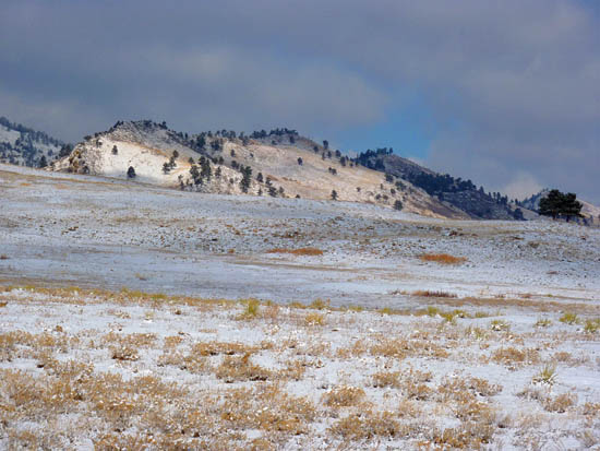
PHOTO CREDIT: PROTRAILS.COM
As I write, snow still clings to the neighborhood rooflines and shady corners of yards; the signs of the first storm of winter slowly melting away. Today's adventure marks, in my mind, the official start of winter. To celebrate I headed up to Boulder, a place I have lived before and a place where trails are right outside the door (literally). It's a trail runner's nirvana and I wanted to get on the trail. My 5K training program suggested a five mile run and I found a route in North Boulder that would accomplish both the goal of getting on trail and that would hit the right distance. As I drove into town, an iconic image of the Flatirons, the steeply-tilted mountains of stone jutting out above Boulder greeted me. This morning they were shining with a patina of fresh snow under a broken sky, thick wisps of clouds clinging to a few of the peaks as though they had gotten hung-up on the rocky points during their low-altitude transit.
The Foothills Trailhead on the north side of town served as the starting point for this adventure and as I ran up the snow-packed trail I passed a still-quiet prairie dog town and entered a steep-sided foothills gully. The climb up the gully along with the cold wintry air deflated my lungs and slowed my pace dramatically until the top of the short climb. There, at a junction, the trail bent to the South and thankfully followed a flat bench parallel to the foothills sweeping higher to the west. I've always liked the hogback ridges above Boulder, the narrow summits of which often have a thin line of silhouetted trees poking up into the sky. Being Boulder, an active town if there ever was one, I passed many other trail runners, dog walkers, and even some eager nordic skiers greeting the chilly weather and light snow cover enthusiastically. The route led me through the Trailhead on Lee Hill Road and by the grassy flats kept open as a landing site for the paragliders that soar from the slopes above the trail. A fun, swooping descent led down down to the community surrounding Wonderland lake. A few Canada geese yet to take to southern skies floated on the surface of the small lake as I circled around and made my way back along the route I had come. By this time, the sun had melted the remaining snow leaving the trail soggy and making for a satisfyingly sloppy finish.
P&P Bonus
In summer 2013 the city and county of Boulder instituted parking fees for non-county visitors. If you don't live in Boulder County, but still want to take advantage of the great trails that the city has maintained, head farther North. The Foothills Trailhead is one of many in the city that still do not have any fees. To see which trailheads require fees click here.
Go Do It
The Foothills Trailhead is about 4 miles north of Boulder's town center. Reach it by taking US 36 W out of town (US 36 cuts south and north through Boulder as 28th Street) and turn right onto Broadway street. The trailhead will be on the left about one-half mile along Broadway where it is marked with a sign and a fenced-in lot. There will be a Subaru, Volvo, or Tacoma parked there. Trails head off to both the east and west, but the trail described here starts right from the trailhead lot and goes west through the underpass under Highway 36. You can see the detailed running route at this link.
